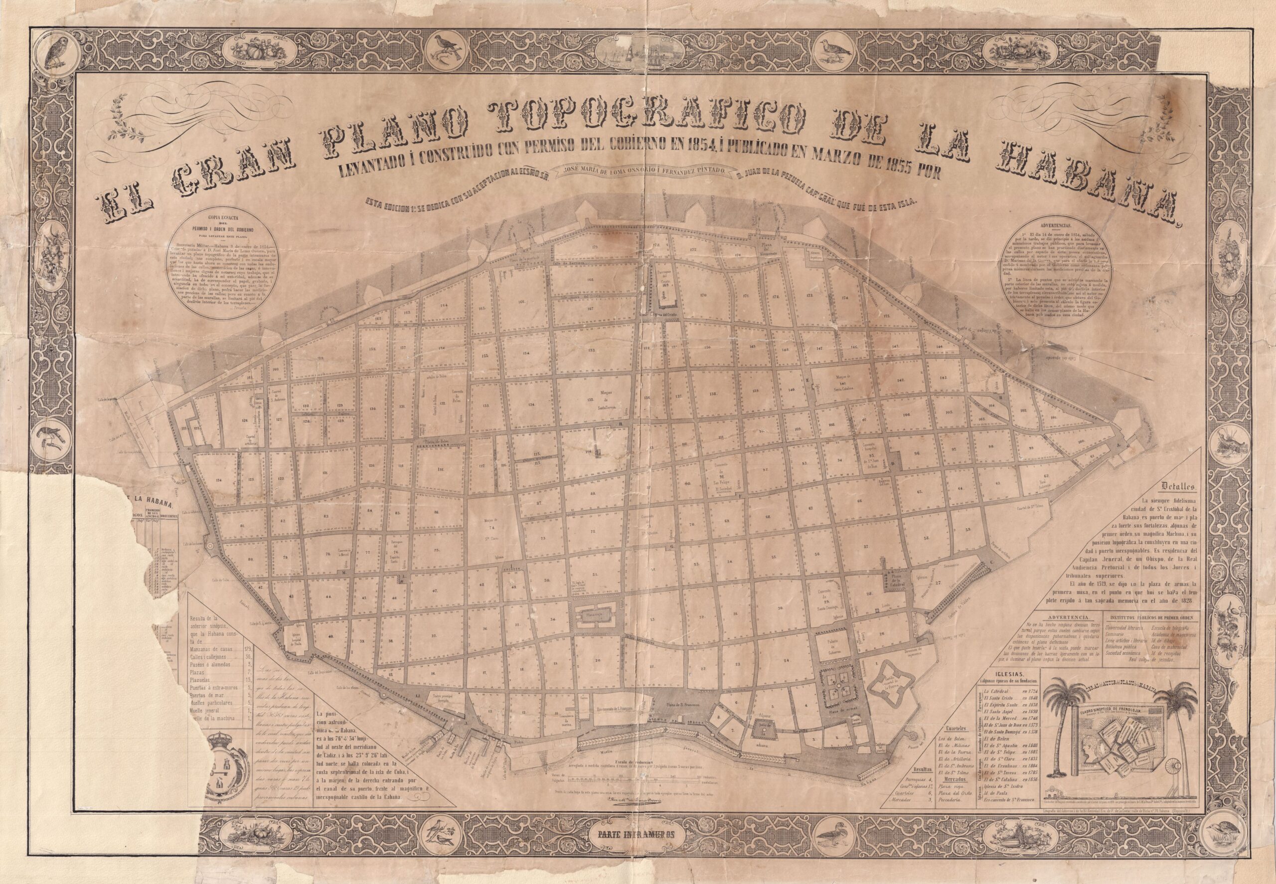
This map of the walled city of Havana, Cuba, was drawn up in 1854 by José María de Loma Ossorio. In March 1855 it was published in agreement with the local government. It is oriented with the southwest at the top, as indicated by the arrow on the right-hand side.
The map covers only the area within the city walls. Havana's city walls were fully operational between 1740, when the area facing the bay (at the bottom of the map) was closed off, and the collapse of a wall next to the Monserrate Gates, to the south-west, at the top of the map. This collapse was followed by many others, completely destroying the wall at the beginning of the 20th century. Some remains of this wall are still preserved, but no functional part of it remains.
In 1855, Havana had a population of over 120,000 inhabitants and its area far exceeded the walled zone shown on this map.
Sources

