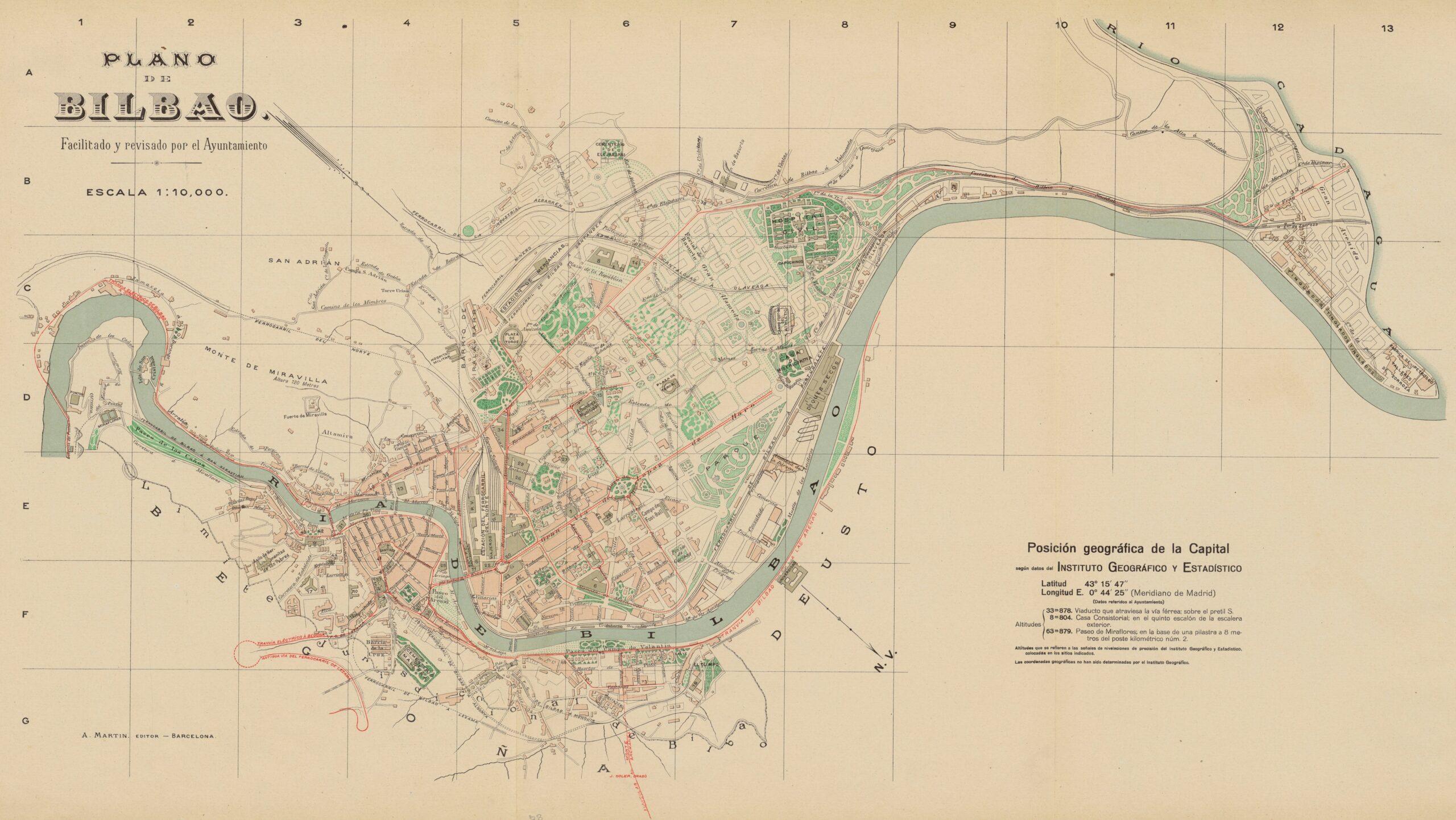
Map of the city of Bilbao published in Barcelona in the early 20th century by Alberto Martín, with information provided and reviewed by the city council. It is currently part of the National Geographic Institute's map library. The map is oriented with the southwest at the top.
The map has the peculiarity of simultaneously showing the location of the city and existing buildings, as well as the complete plan for the expansion of Bilbao in a dotted line. This expansion had been approved in 1876, with the project designed by the team of architect Severino de Achúcarro, and took up the riverbank where it was located on land belonging to the municipality of Abando, which was annexed to Bilbao in 1890.
Although this map is dated 1910 by the National Geographic Institute, it has the peculiarity of showing the layout of the new San Mamés football stadium, whose location was agreed upon by a board of members at the end of 1912. Its construction took place in the early months of 1913, so as the stadium does not appear on the map, this must have been the year of its publication.
Sources

