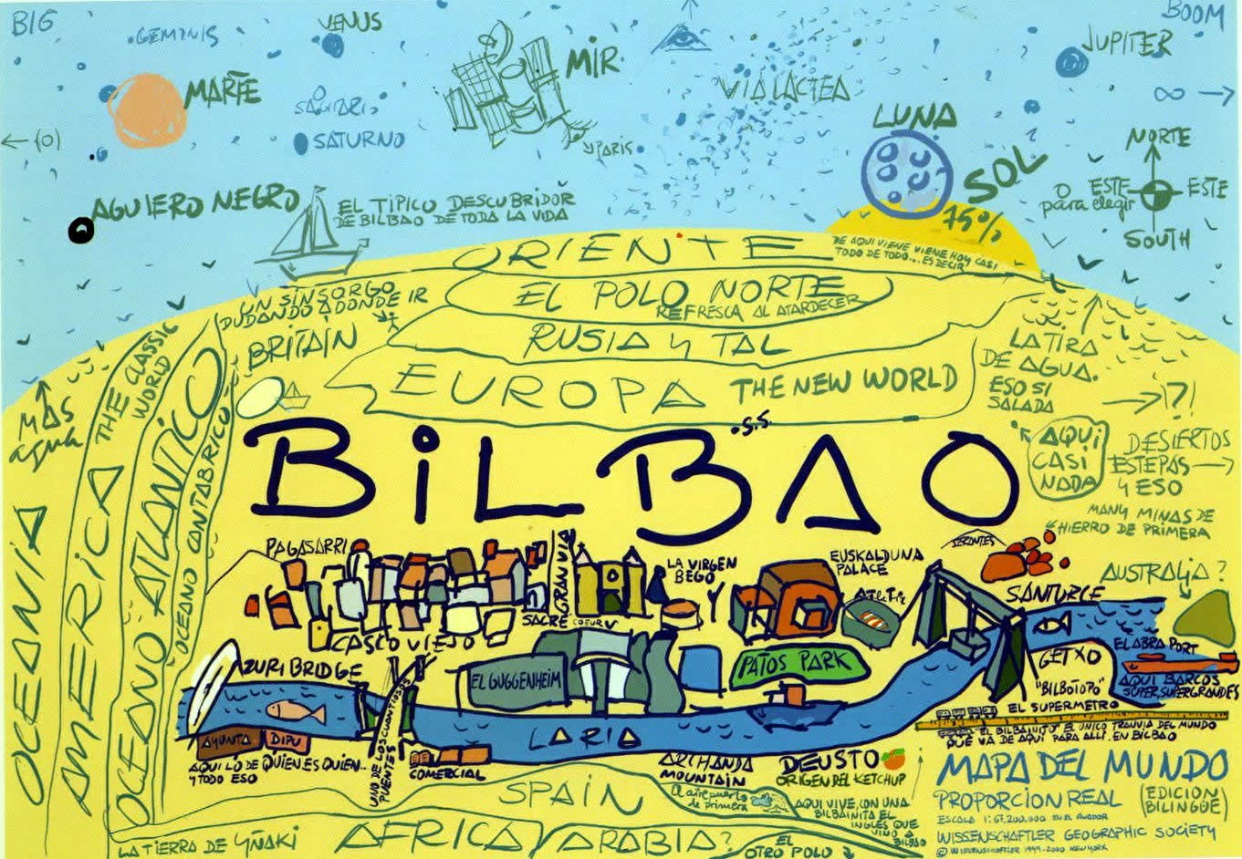
This well-known map from the year 2000, created by JEK Larson (pseudonym of artist Juan Echegoien Krug), humorously depicts the city of Bilbao (Spain) as the centre of the world.
On the map, Bilbao appears oversized in the centre, with a wealth of details about the city such as the Guggenheim, the Euskalduna and the Old Town. The countries and regions bordering Bilbao appear in smaller size, such as «Spain» to the south, Europe to the north and the Atlantic Ocean to the west. Much smaller, at the edges of the land area, are more distant continents such as Africa, America and Oceania. At the top are regions of near and distant space.
Sources

