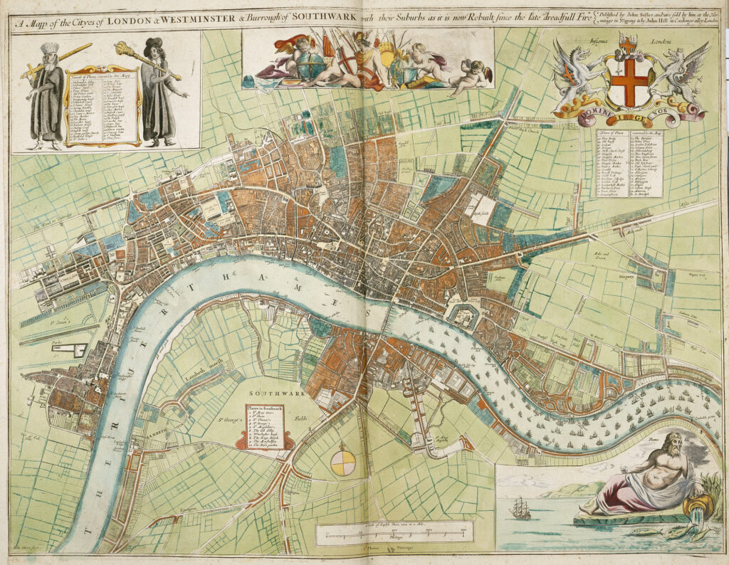
This map, published by John Seller in 1680, is part of the British Library collection. The map covers the cities of Westminster and London, which were independent at the time, and the borough of Southwark, south of the River Thames, which was a dependency of the City of London.
The map was published fourteen years after the Great Fire that destroyed the medieval walled city of London in 1666. It is estimated that 70,000 of the city's 80,000 inhabitants lost their homes in this event, in addition to the complete destruction of iconic buildings such as the old St Paul's Cathedral. This document shows how the city had already been completely rebuilt. Even the new St. Paul's Cathedral had already begun to be built in 1676.
The borough of Southwark was the only populated area of south London, thanks to the only bridge over the River Thames in the vicinity of London, known as London Bridge. This construction was lined with shops and houses along its length, although they are barely visible on this map, as many of those that existed on the northern side were also destroyed in the fire.
Sources

