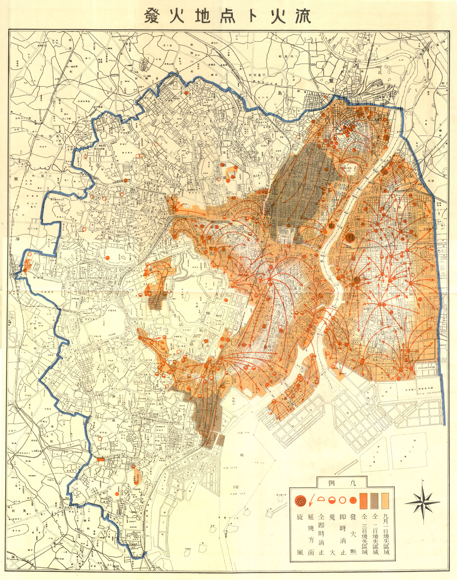
This map was published by the publishing house Japan Statistical Association in 1930, as part of the study for the reconstruction of Tokyo after the destruction caused by the Great Kantō Earthquake in 1923.
On 1 September 1923, an earthquake struck the Kantō region. In addition to the direct consequences of the earthquake, multiple fires broke out because most houses were cooking food on charcoal grills. Firefighters found that many of the water reservoirs had been destroyed, so the fires spread quickly, destroying more than half of Tokyo and much of Yokohama.
This map shows the origins of the fires and how they spread throughout the city. The different colours indicate the areas that burned on 1 September (yellow), those that burned on 2 September (brown) and those that were destroyed by fire after 48 hours (dark orange).
In the newsletter, I wrote a detailed article about the earthquake and its consequences (with maps). You can read it in full here..
Sources
- Map indicating the origin points of fires and their spread
- The Great Kantō Earthquake of 1923 – Map Archive

