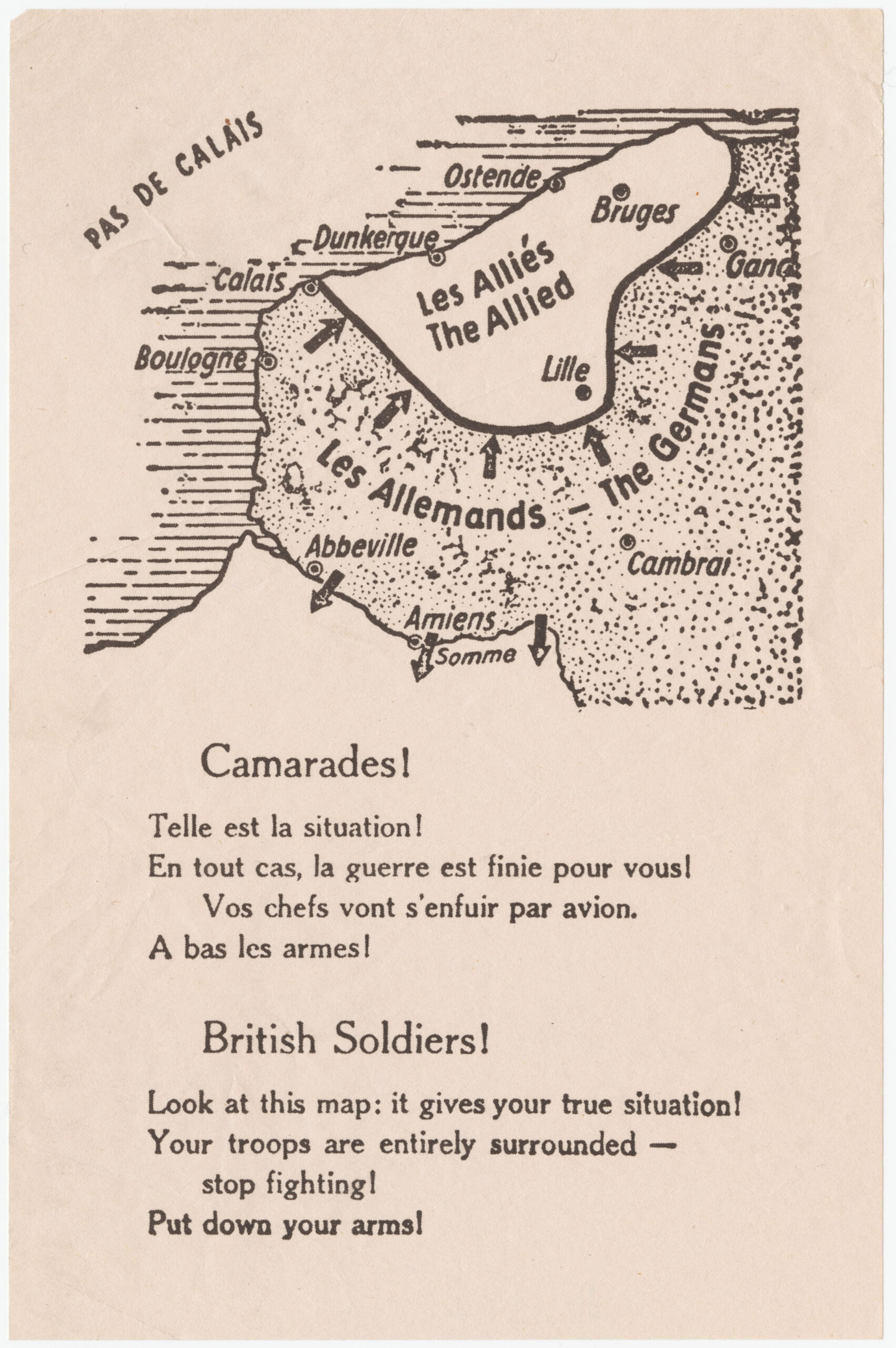
This map was printed on millions of leaflets dropped by the German air force on Allied troops, French and British, surrounded around Dunkirk, on the border between France and Belgium, in May 1940.
The map uses horizontal lines to identify the sea and dots to mark all the territory conquered by Germany. It also includes a series of arrows on all fronts, creating a sense of constant and inescapable pressure from the German army on the shrinking Allied territory.
The leaflets were also accompanied by two texts addressed to Allied soldiers, but each audience had its own message. The message addressed to the French referred to the fact that their leaders had already left the country and that the war was over for them, with Germany seeking surrender in the face of the impossibility of victory. On the other hand, the message addressed to the British sought to make soldiers aware that the situation was complicated and that there was no point in continuing to fight. They were asked to surrender and lay down their arms.
In both messages, the pamphlet was being used as a means to connect with low morale and despair, and thus prevent this final battle from causing effort or casualties for the German army. It is difficult to determine to what extent this propaganda had any real effect, as a significant portion of the Allies managed to escape the siege thanks to the success of Operation Dynamo, which evacuated Dunkirk.
If you would like more information about this type of propaganda, I recommend you take a look at this article on leaflets.
Sources

