
This map was drawn by Howard Burke and published by the San Francisco Examiner newspaper in October 1940, in the context...
Maps from 1940
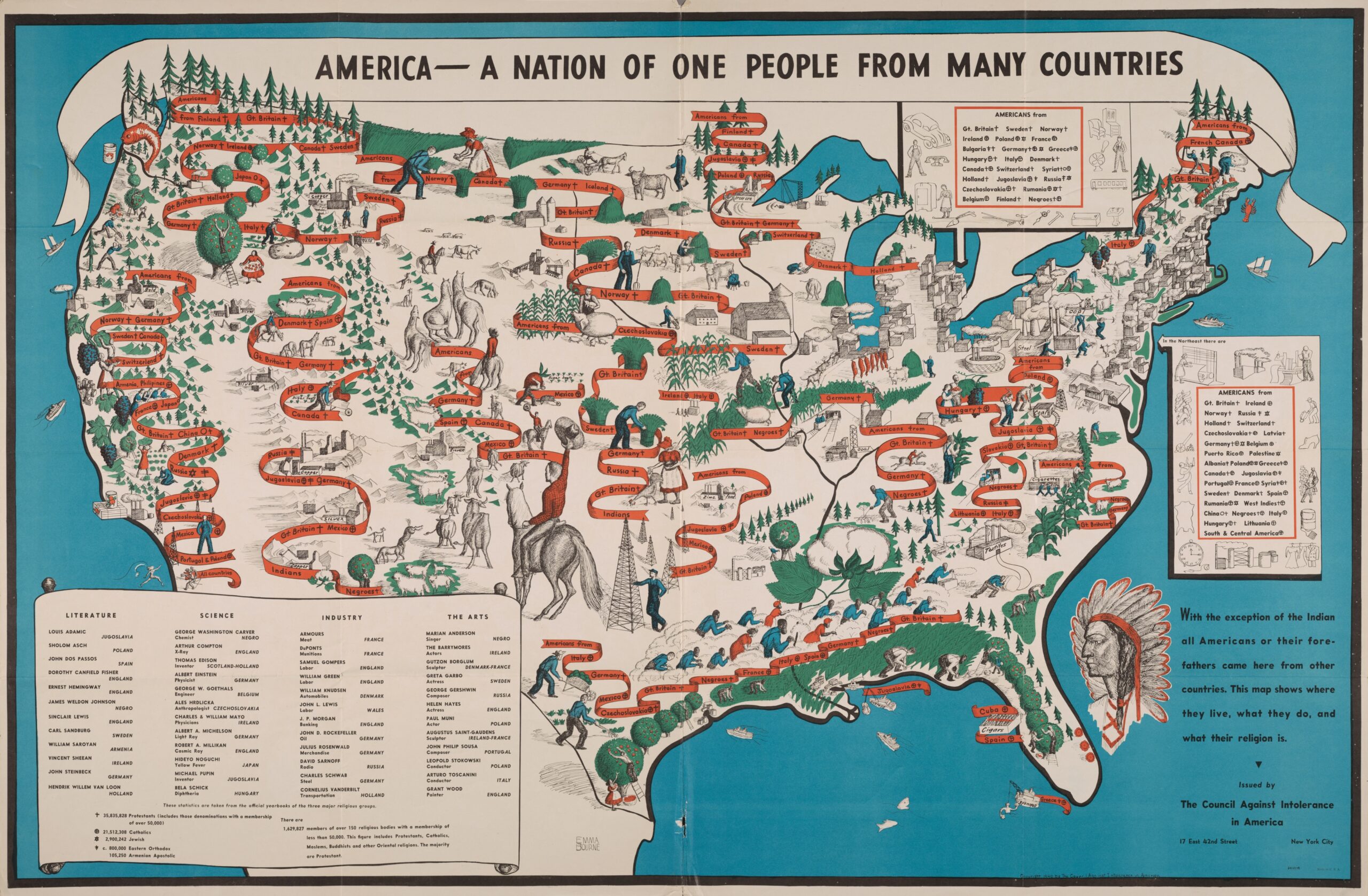
The United States, one people from many countries (1940)
This map was drawn by Emma Cartwright Bourne in 1940 for The Council Against Intolerance in America.

Japan and Russia will divide China (1940)
This map was drawn by Howard Burke and published by the Milwaukee Sentinel newspaper in April 1940, in the context...

Italy hopes to bring back the Roman Empire (1940)
This map was drawn by Howard Burke and published by the New York Journal-American newspaper in 1940, in the...

Towards a New World Order, Part 2 (1940)
This map first appeared in a 1940 edition of the Japanese magazine Comrades and Students at the Front...

Numbering of roads in Spain (1940)
This map appears in the General Plan for Public Works, published by the Spanish Ministry of Development in 1940.

Towards a New World Order, Part 1 (1940)
This map first appeared in a 1940 edition of the Japanese magazine Comrades and Students in the...

Franco's victory (1940)
This map, drawn by cartoonist Francisco López Rubio, was published as part of the historical series Cartografía Hispánica en…

Mare Nostrum (1940)
This map was published in 1940 as the back cover of many notebooks provided in schools by the government of...

The Russian Spider Seeks New Victims (1940)
This map was drawn by Howard Burke and published by the Los Angeles Examiner newspaper in 1940, in the context...
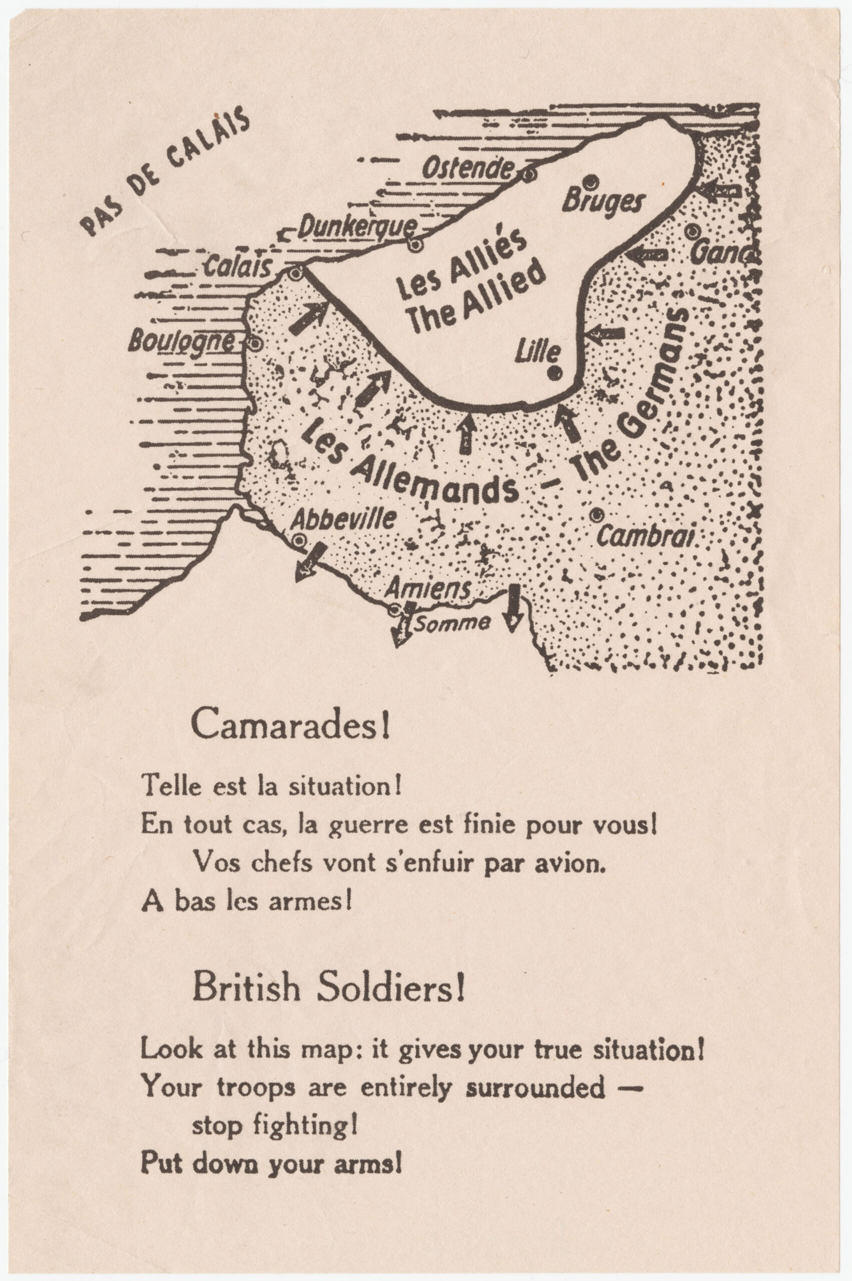
The Dunkirk leaflets (1940)
This map was printed on millions of leaflets that the German air force dropped on Allied troops, French troops...
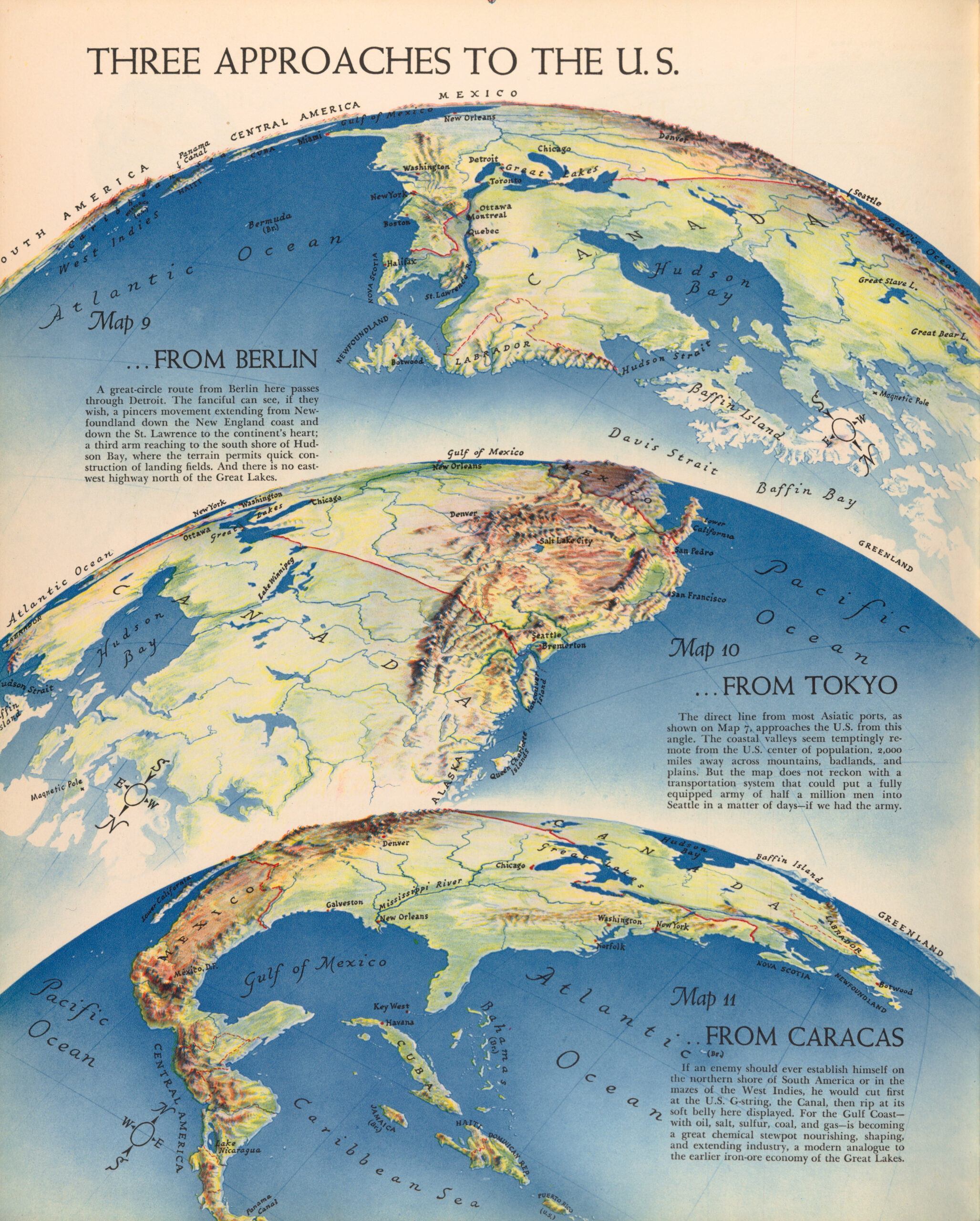
The Three Ways to Attack the United States (1940)
This illustration was published in 1940 by Richard Edes Harrison in his book Atlas For The U.S. Citizen. In...
 Español
  English (UK)