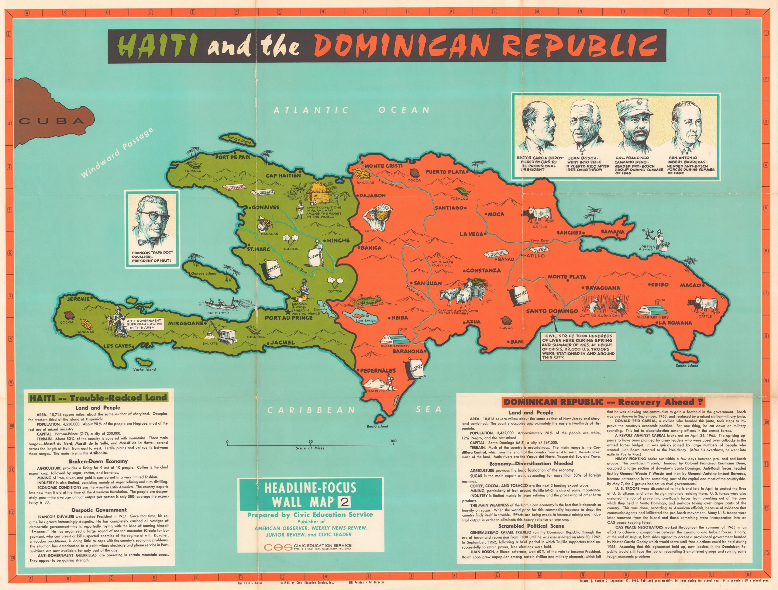
This map was published in September 1965 by Civic Education Service, a US publisher of educational resources. The map covers Hispaniola and its two constituent countries, Haiti and the Dominican Republic.
The Civic Education Service was a publishing house that was active between 1963 and 1972, in the context of the Cold War. Its maps sought to explain in schools the international conflicts of the time in which the United States was involved. Much of the narrative of this entity was to portray US military interventions as acts of stabilisation.
This map saw the light of day in the context of the crisis in the Dominican Republic, one of the most important episodes of the Cold War in the Caribbean. In April 1965, a constitutionalist movement had attempted to re-establish the democratic presidency of Juan Bosch, who had been overthrown by a military coup in 1963, leading to civil war in the country. Faced with the advance of the constitutionalists, the US government sent 22,000 marines to Santo Domingo, with the objective of preventing a second Cuba. Thanks to US intervention, Juan Bosch's return was prevented.
The map incorporates multiple references to this conflict, such as the images of the leaders of the opposing forces in the Dominican Republic, although the red colour given to the country was always used by the Civic Education Service to refer to communist dangers. Both the territory of Haiti and the Dominican Republic are replete with pictorial images that make direct reference to the economy of both countries.
Sources

