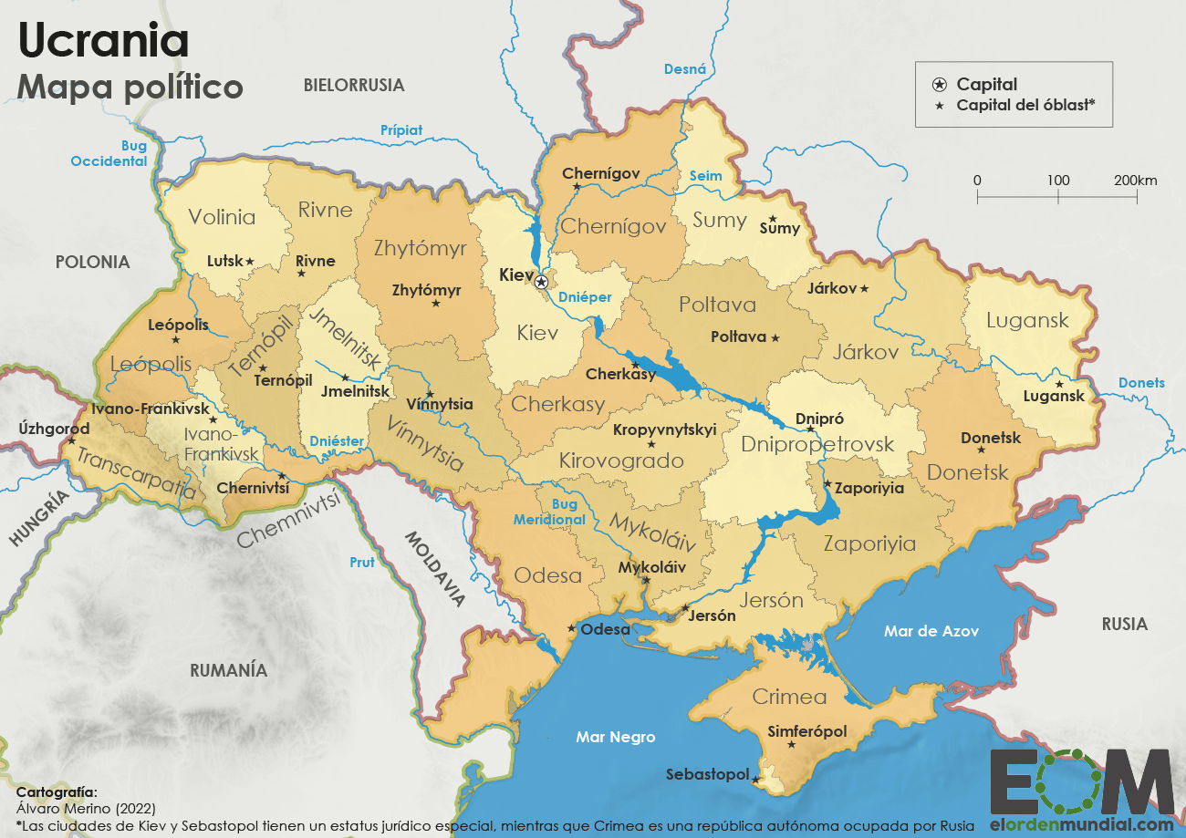
This map, created by Álvaro Merino for El Orden Mundial, shows the territorial division of Ukraine, with its 24 oblasts and their respective capitals, the city of Kyiv, the Autonomous Republic of Crimea and the city of Sevastopol.
The country’s main rivers are marked in blue, including the Dnieper (which flows through Ukraine from north to south, fed by a series of large reservoirs), the Desna, the Pripyat, the Western Bug, the Southern Bug, the Dniester, the Prut and the Donets. The last of the Dnieper’s reservoirs, the Kakhovka Reservoir in Kherson, was drained in June 2023, following the destruction of the dam.
On this map, Crimea appears within Ukraine’s borders, with a note indicating that it is occupied by Russia, whilst the Donetsk and Luhansk oblasts are shown in their entirety, without distinguishing the areas controlled since 2014 by the self-proclaimed people’s republics. In September 2022, Russia proclaimed the unilateral annexation of these two oblasts, as well as those of Zaporizhzhia and Kherson.
Sources


 Español
 English (UK)