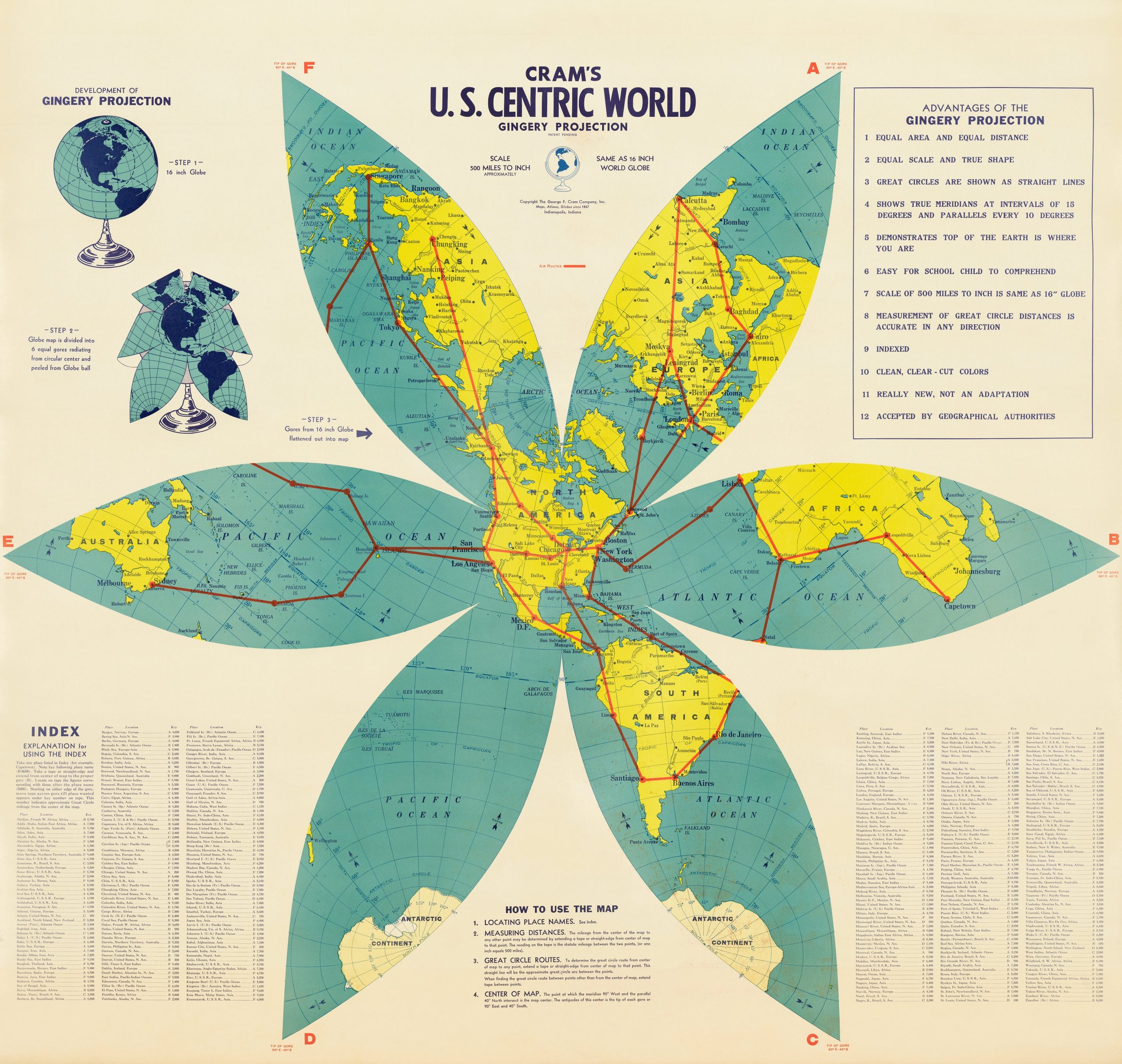
This map, published by the George F. Cram Company in 1943, depicts the world using the Gingery projection, devised by Walter Gingery, an American secondary school teacher.
This projection is based on a globe divided into six zones that share the same vertex. The zones are cut from the opposite point and unfold onto the plane, whilst maintaining a central circle that remains intact. The result is a six-petalled flower shape, in which the central circle functions as an equidistant azimuthal projection, ensuring that distances from the centre are preserved, as are those along the axis of each petal.
The location chosen in Cram’s version is in the state of Illinois, in the United States. The red lines correspond to the main air routes that ran from North America to the rest of the world.
In the top left-hand corner, there are some illustrations explaining how the projection is constructed. In the top right-hand corner, there is a list of the twelve advantages of the projection, which exaggerate the reality of this projection. Among other things, the list claims that the projection is equivalent, equidistant and shape-preserving – something that no single projection can achieve simultaneously.
You can read more about map projections in this article: Cartographic projections: distorting the Earth in order to represent it
Sources


 Español
 English (UK)