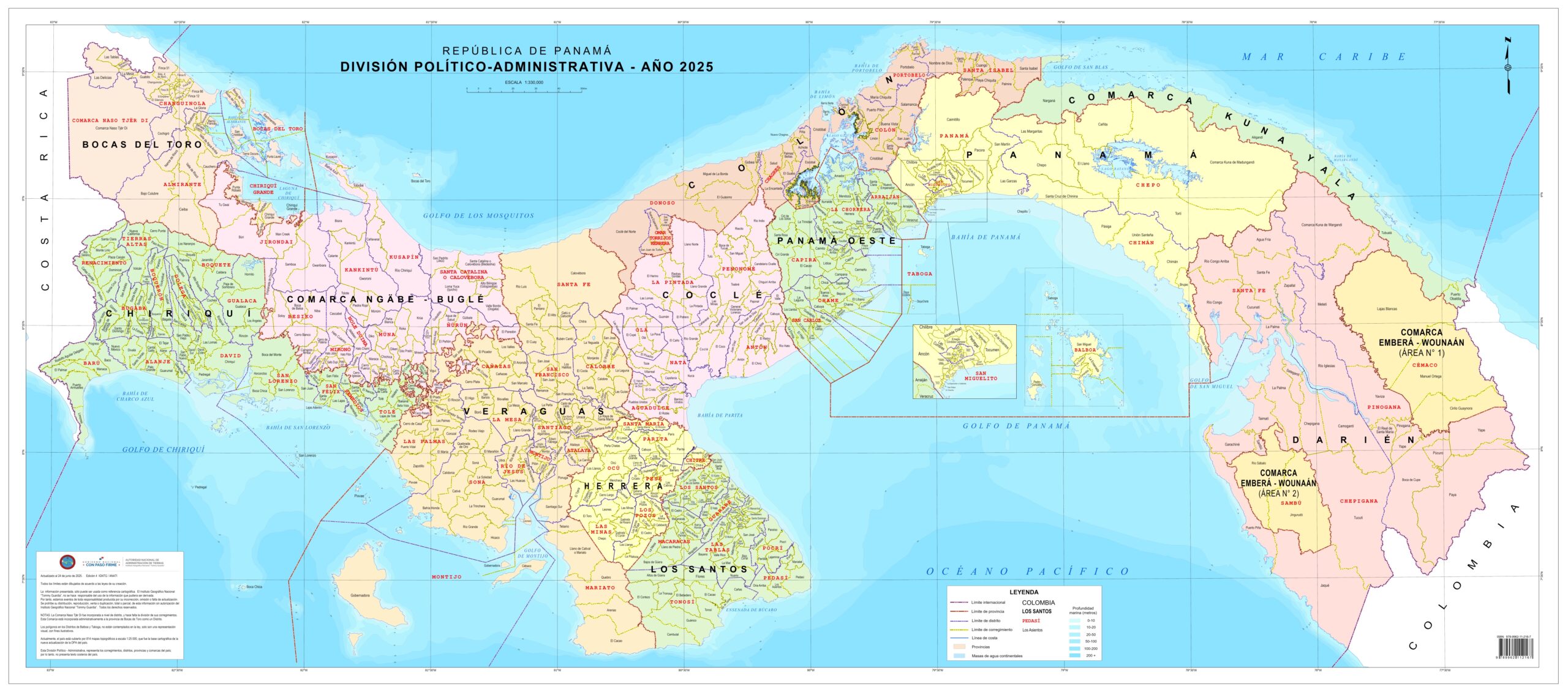
This map, published by the Tommy Guardia National Geographic Institute (IGNTG) in 2025, shows the administrative division of the Republic of Panama.
The map shows the ten provinces of the country in different colours: Bocas del Toro, Chiriquí, Veraguas, Herrera, Los Santos, Coclé, Panamá Oeste, Colón, Panamá and Darién. In addition, the map also shows the four indigenous comarcas: Ngäbe-Buglé, Naso Tjër Di, Guna Yala and Emberá-Wounaan.
The map also includes the division of provinces and counties into districts and townships. The only exception is Naso Tjër Di County, which, as the newest county, did not yet have defined townships when the map was created.
Sources

