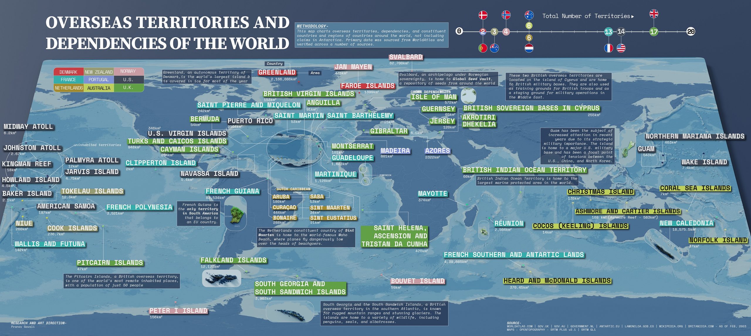
This map, created by Pranav Gavali Produced for the Visual Capitalist website in 2023, it shows the 71 overseas territories, dependencies, constituent countries and regions of countries around the world, grouped according to the state to which they belong.
Listed in descending order of number of territories, these are the countries mentioned:
- United Kingdom, shown in dark green (17)
- United States, in grey (14)
- France, in blue (13)
- Australia, in light green (6)
- The Netherlands, in orange-brown (6)
- Norway, in pink (4)
- New Zealand, shown in greenish-brown (3)
- Denmark, in the red (2)
- Portugal, in lilac (2)
The vast majority of these territories are located in the Caribbean or the Pacific Ocean. Some of the points highlighted on the map, such as Baker, Howland and Jarvis, are uninhabited islands which the United States claimed under the Guano Islands Act of 1856.
The author groups territories with very different statuses into the same category. These include 16 of the 17 non-self-governing territories that the UN considers to be pending decolonisation, such as Gibraltar, the Falkland Islands and New Caledonia (the only one missing is Western Sahara). However, the list also includes French departments such as Guadeloupe and Réunion, and autonomous regions of Portugal such as the Azores and Madeira.
As a point of interest, the map omits the Canary Islands and Hawaii, which, according to the map’s broad definition, ought to be shown.
Sources


 Español
 English (UK)