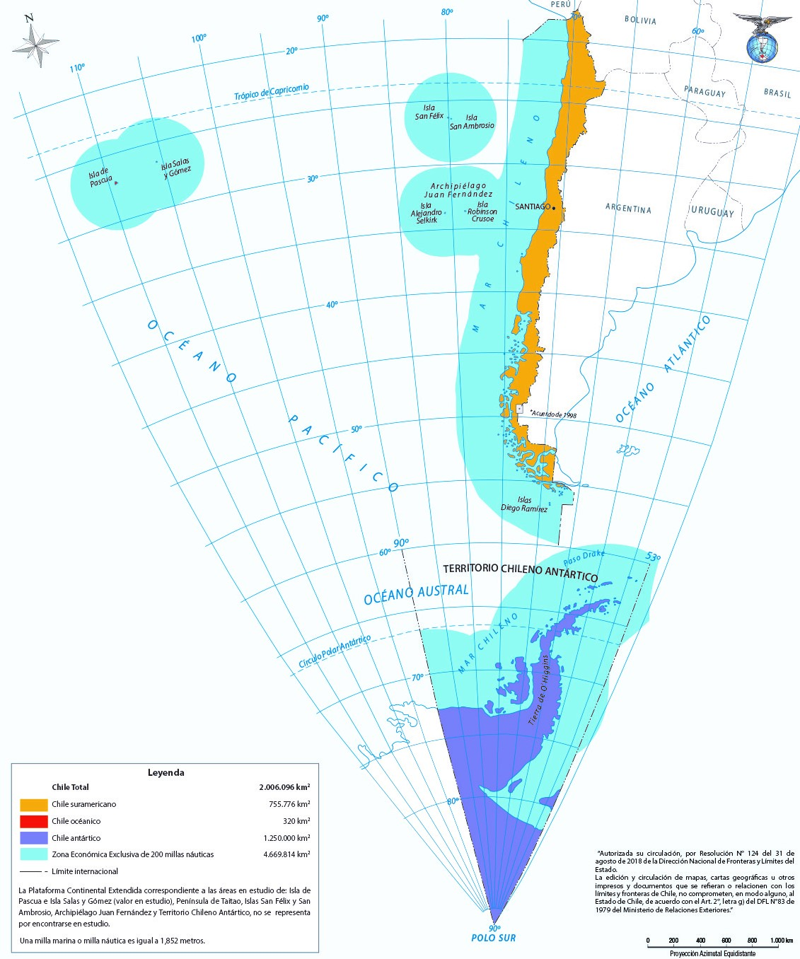
This map, published by the Military Geographic Institute of Chile with information provided by the National Directorate of State Borders and Boundaries, represents the official map of Chile.
The map uses three colours to represent the three continents where Chile claims a presence:
- Orange: Mainland territory in South America and archipelagos near the coast, with international recognition.
- Purple: Continental territory in Antarctica, without international recognition (like any territory claimed in Antarctica).
- Red: Easter Island in Polynesia, part of Oceania, with international recognition.
Through Easter Island, in 2018 Chile became part of the Polynesian Leaders Group, thereby deepening its relations with other nations in the Pacific Ocean.
Sources

