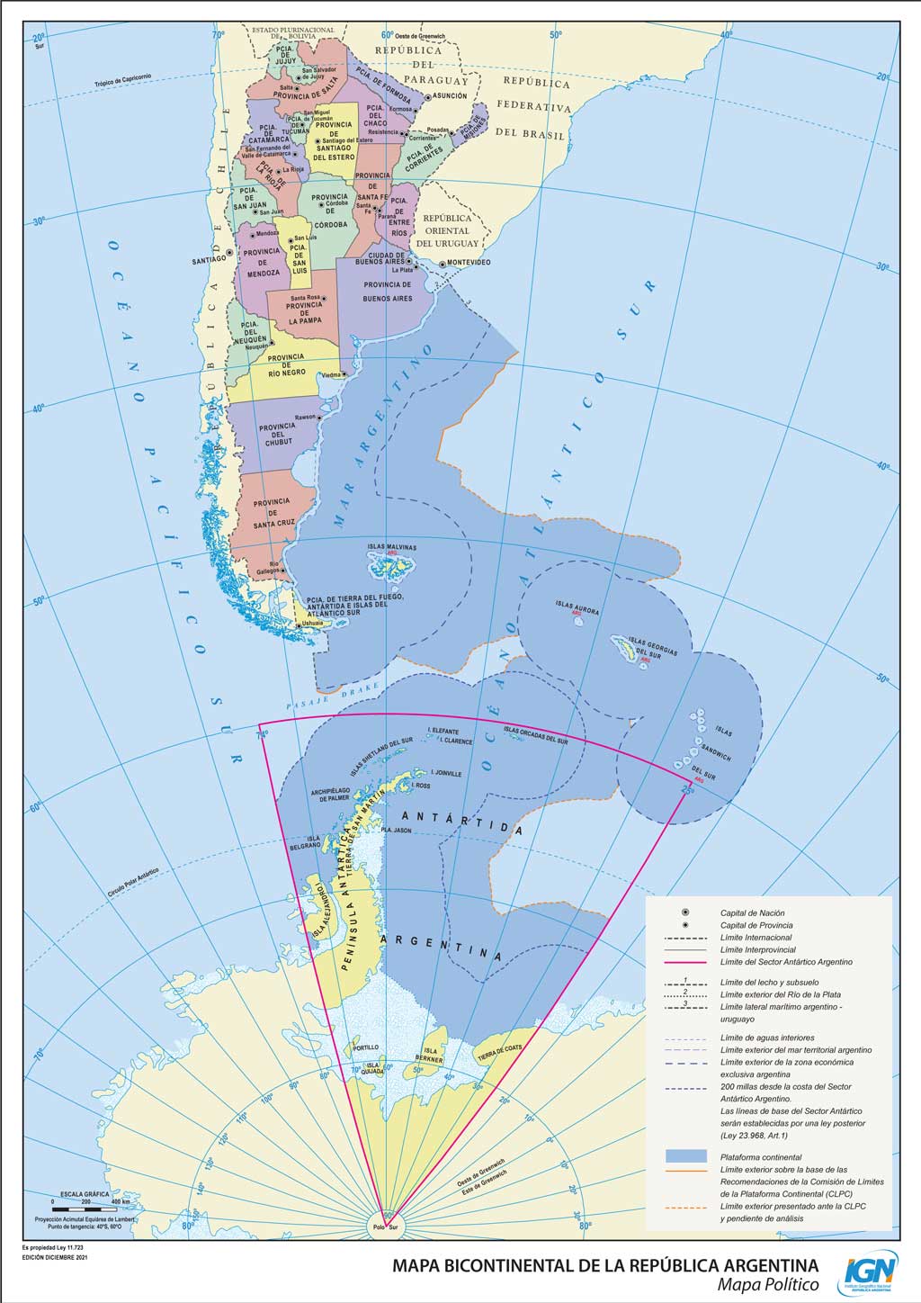
This map, published by the National Geographic Institute of the Republic of Argentina, is the official map of the nation. It spans two continents, South America and Antarctica, and covers the following regions:
- Mainland territory of South America, recognised by the international community.
- Falkland Islands, disputed by the United Kingdom.
- South Georgia Islands, disputed with the United Kingdom.
- South Sandwich Islands, disputed by the United Kingdom.
- Mainland territory in Antarctica, without international recognition (like any territory claimed in Antarctica).
The great importance of the islands disputed with the United Kingdom does not lie solely in the islands themselves, as the South Sandwich Islands and South Georgia Islands are barely habitable. The relevance lies in the rights granted over the surrounding sea to each of the islands, as indicated by the darker blue on the map.
Sources

