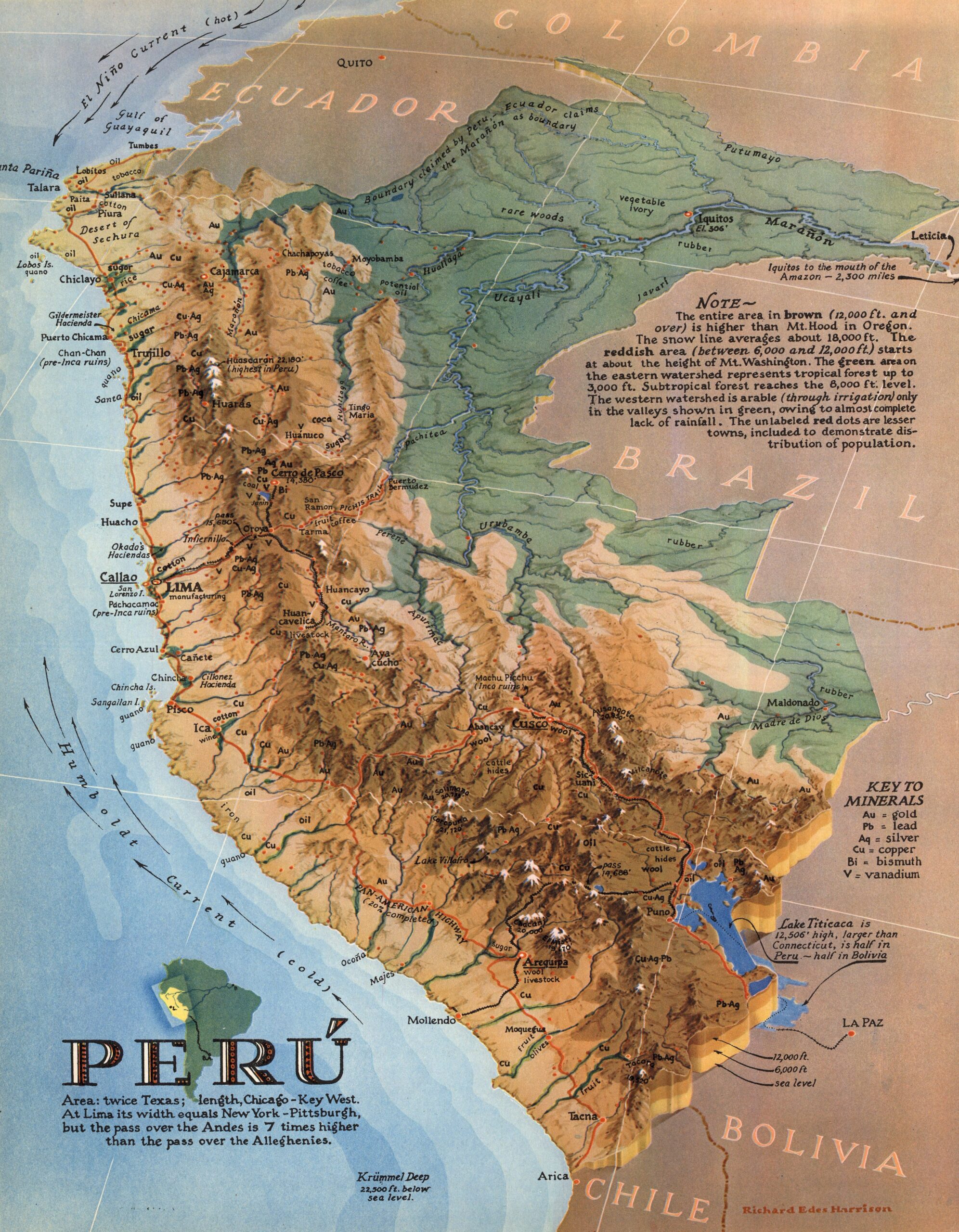
This map of Peru, drawn by Richard Edes Harrison, was published in the magazine Fortune in January 1938.
It is a physical map, but in the author's particular style, combining a bird's-eye perspective with exaggerated reliefs, including shadows. In addition to the main cities, the most important rivers and mountains are also labelled. The legend also shows the location of the country's main mineral extractions.
Part of the purpose of the map was to make Americans aware of Peru's high altitude, which is why Harrison includes several comparisons in the text: the entire area in dark brown is at an altitude of over 12,000 feet (3,658 metres), higher than Mount Hood in Oregon; the area in light brown is at an altitude of over 6,000 feet (1,829 metres), higher than Mount Washington in New Hampshire.
Sources

