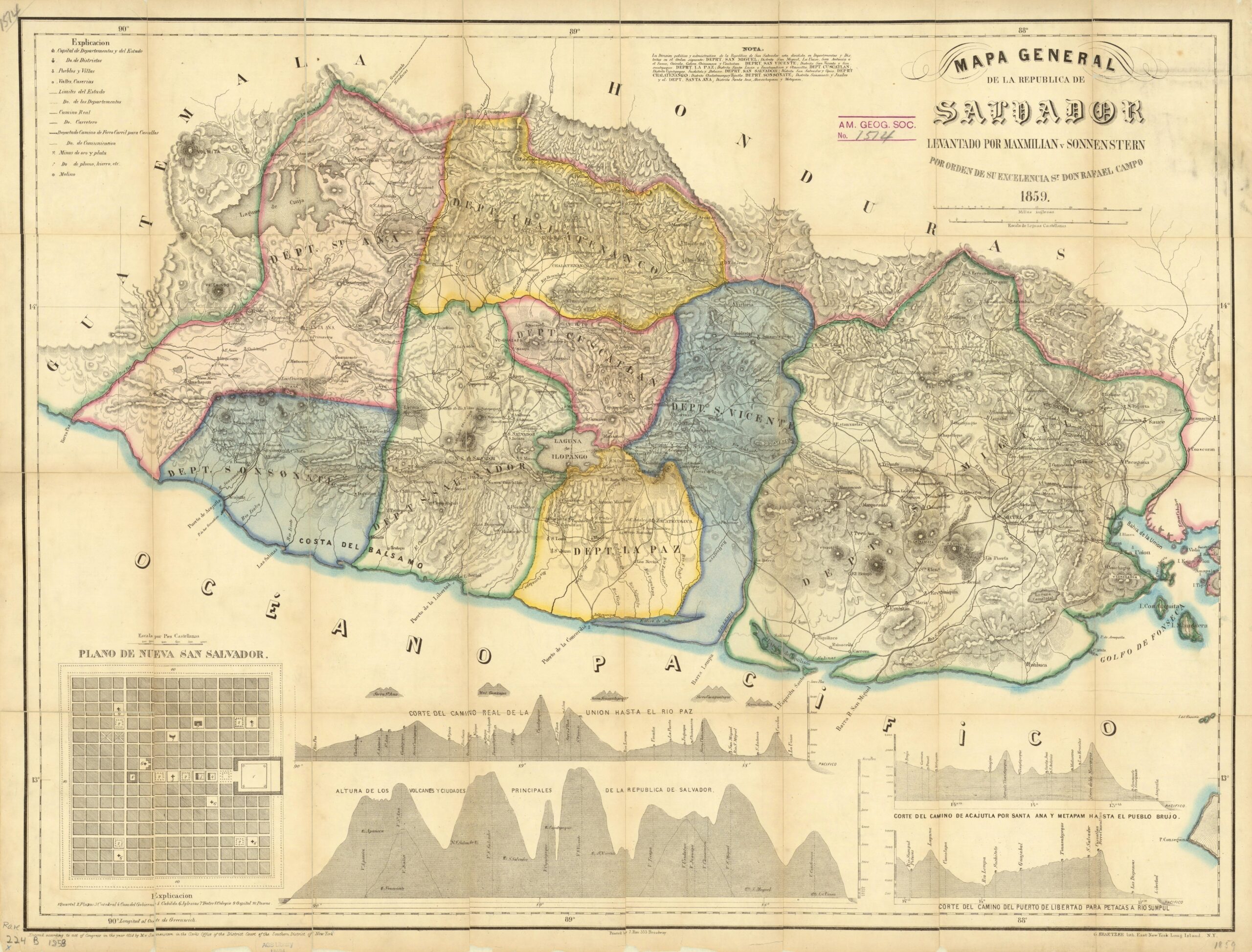
This map was made in 1858 by the German cartographer Maximilian von Sonnenstern and published a year later, in 1859. It was commissioned by El Salvador's president Rafael Campo y Pomar and became the first official map of the country.
Sonnenstern travelled the territory for a year and a half to carry out the topographic survey of El Salvador. The result organises the country into the eight departments it had at the time: Sonsonate, Santa Ana, La Paz, Chalatenango, San Salvador, Cuscatlán, San Vicente and San Miguel. The map also depicts cities, towns, rivers, roads, mines and even projected railway lines.
At the bottom left, the map incorporates a plan of Nueva San Salvador, the city built in 1854 to replace San Salvador after its destruction by the earthquake of that year. This new capital never became the capital, as San Salvador was rebuilt and regained its function.
Sources

