This map was drawn by the American illustrator Ernest Dudley Chase and published under his own imprint in 1942, in the context of World War II.
In the 1940s, Chase was America's most prolific illustrator of pictorial maps. In this case, his subject matter is radically different; no tourist maps, just an aggressive war map. That such an author decided to publish this map under his own imprint speaks volumes about the civilian mobilisation that took part in the American propaganda machine during World War II.
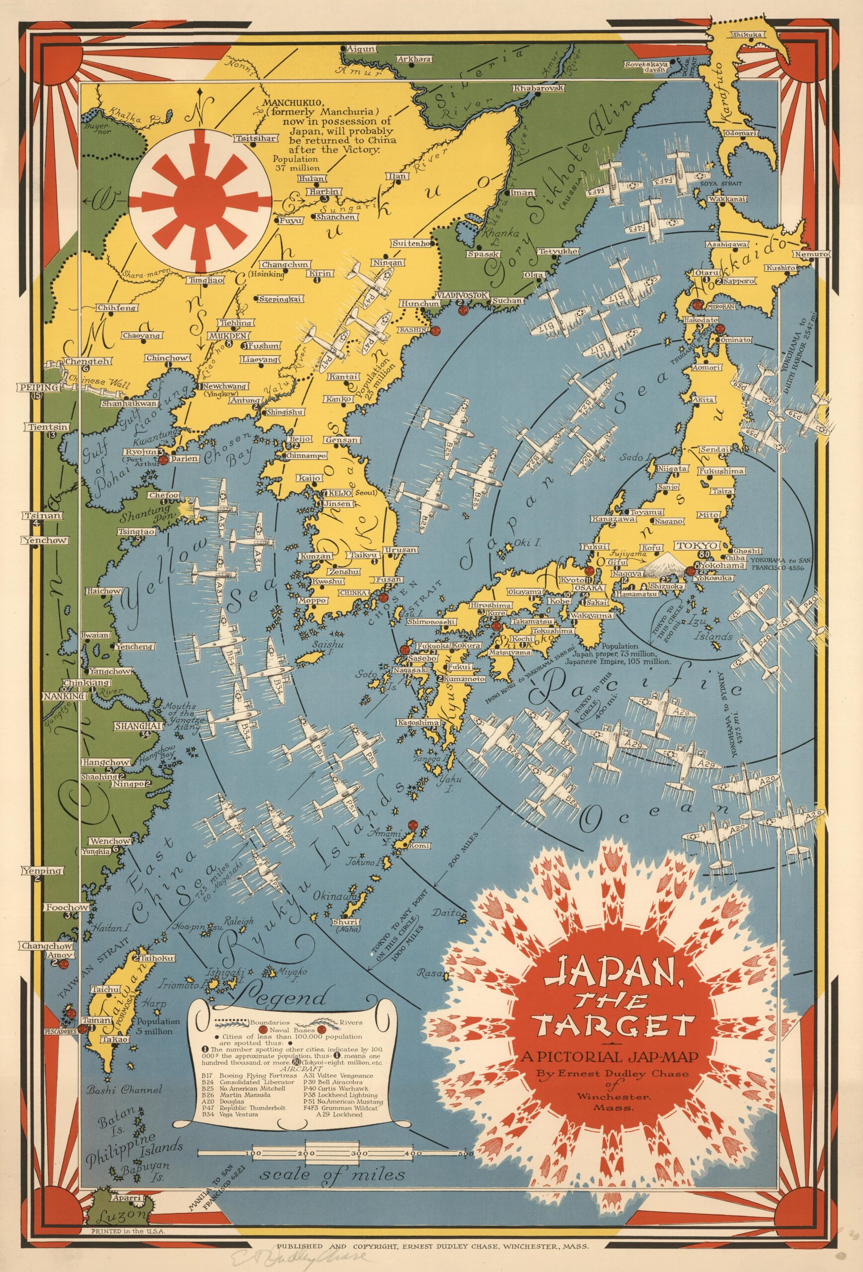
As the most striking point on the map, the author takes the flag of Imperial Japan, the rising sun, and turns it into a shooting target. American fighter planes are approaching the Japanese archipelago, labelled with 14 models that are also described in the legend. Chase conveys an unambiguous idea: Japan is the target and the target is being hit.
The map is published a few months after the attack on Pearl Harbor, and Japan would still take the Philippines or Singapore without the United States being able to do anything to prevent it. It is true that Tokyo was bombed for the first time in April 1942, but at the time the map was published, the reality was far from a Japan retreating in the face of continuous US bombardment. Chase was drawing the US objective, not the reality at the time.
Sources
- Japan, the target : a pictorial Jap-map
- 1944 Ernest Dudley Chase WWII Pictorial Map of Japan and Korea

