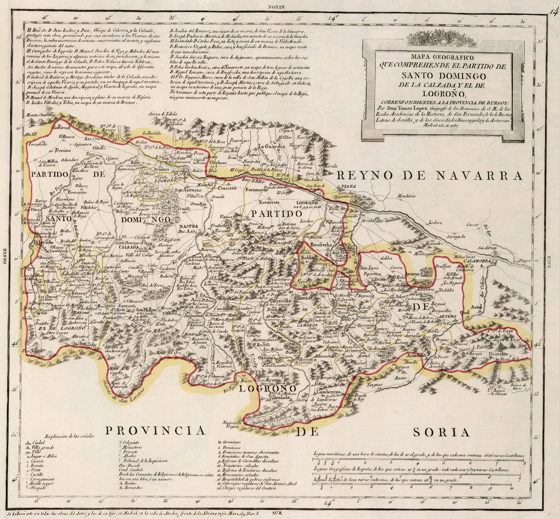
This map was created by Spanish cartographer Tomás López de Vargas Machuca in 1787 and published posthumously by his sons in the “Geographical Atlas of Spain” from 1804. The map depicts the eastern part of the Province of Burgos with the territorial boundaries prior to the provincial administrative reform carried out by Javier de Burgos in 1833.
Although the region of La Rioja did enjoy administrative independence during much of the 16th and 17th centuries, after the War of Succession and the subsequent territorial reorganisation of 1718, this territory became part of the Province of Burgos and the Province of Soria. Specifically, the districts of Santo Domingo de la Calzada and Logroño, as marked on the map, became part of the Province of Burgos, while the easternmost areas became part of the Province of Soria.
The province of Burgos extends westward, beyond the boundaries of this map. Furthermore, these territories border on the Kingdom of Navarre to the north and with the Province of Soria to the south.
At the end of the 18th century, La Rioja society began to organise itself to exert pressure to regain its own province. This culminated in a text published by the Royal Economic Society of La Rioja in 1820, which detailed the reasons why La Rioja should once again become a separate and independent province. This would eventually lead to the territorial reorganisation of 1833 and the creation of the Province of Logroño, which would not regain its historical name until 1980.
You can read more about Tomás López and his atlas in this article from the newsletter: Tomás López and the first detailed atlas of Spain (1804).
Sources

