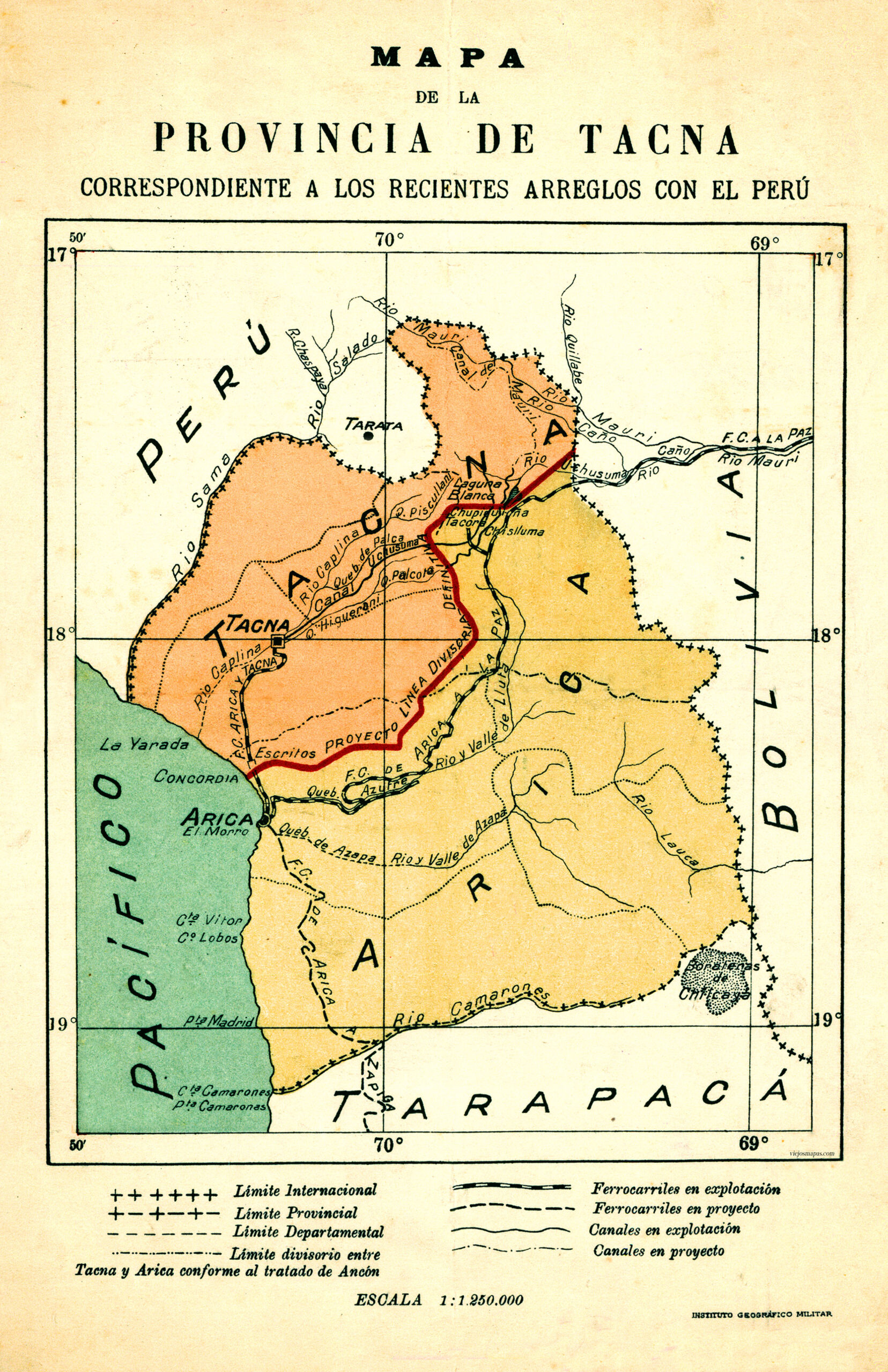
This map was published by the Military Geographic Institute of Chile in 1929. It shows the division of the former province of Tacna between Peru and Chile following the Treaty of Lima, also known as the Rada y Gamio Treaty.
Before 1879, this province was an integral part of Peru. After the War of the Pacific, in which Chile fought Bolivia and Peru, the region came under Chilean administration, as stipulated in the Treaty of Ancón of 1883. That agreement included a condition that the territory should determine its future in a plebiscite ten years later, which never took place.
This territory became part of Chile as the province of Tacna, although the border dispute between Peru and Chile remained unresolved for several decades. In 1929, following arbitration by the United States, an agreement was reached to divide this province in two, with Tacna becoming part of Peru and Arica becoming part of Chile.
Sources

