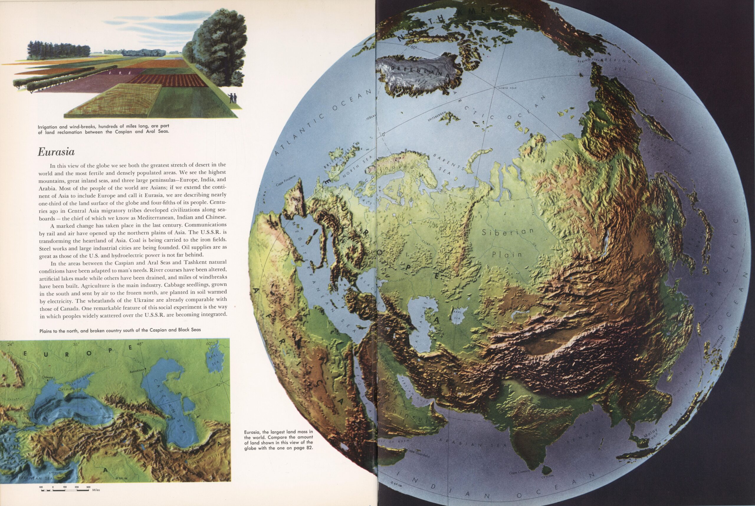
This map was published in 1958 by Frank Debenham as part of his work «The Global Atlas: A New View of the World from Space».
The map shows a physical map of Eurasia, using reliefs and a classic colour palette to represent the altitude of different regions, with browns for elevated areas and greens for areas near sea level. This allows us to appreciate the vast expanse of the West Siberian Plain and the Great European Plain, separated only by the Ural Mountains.
Sources

