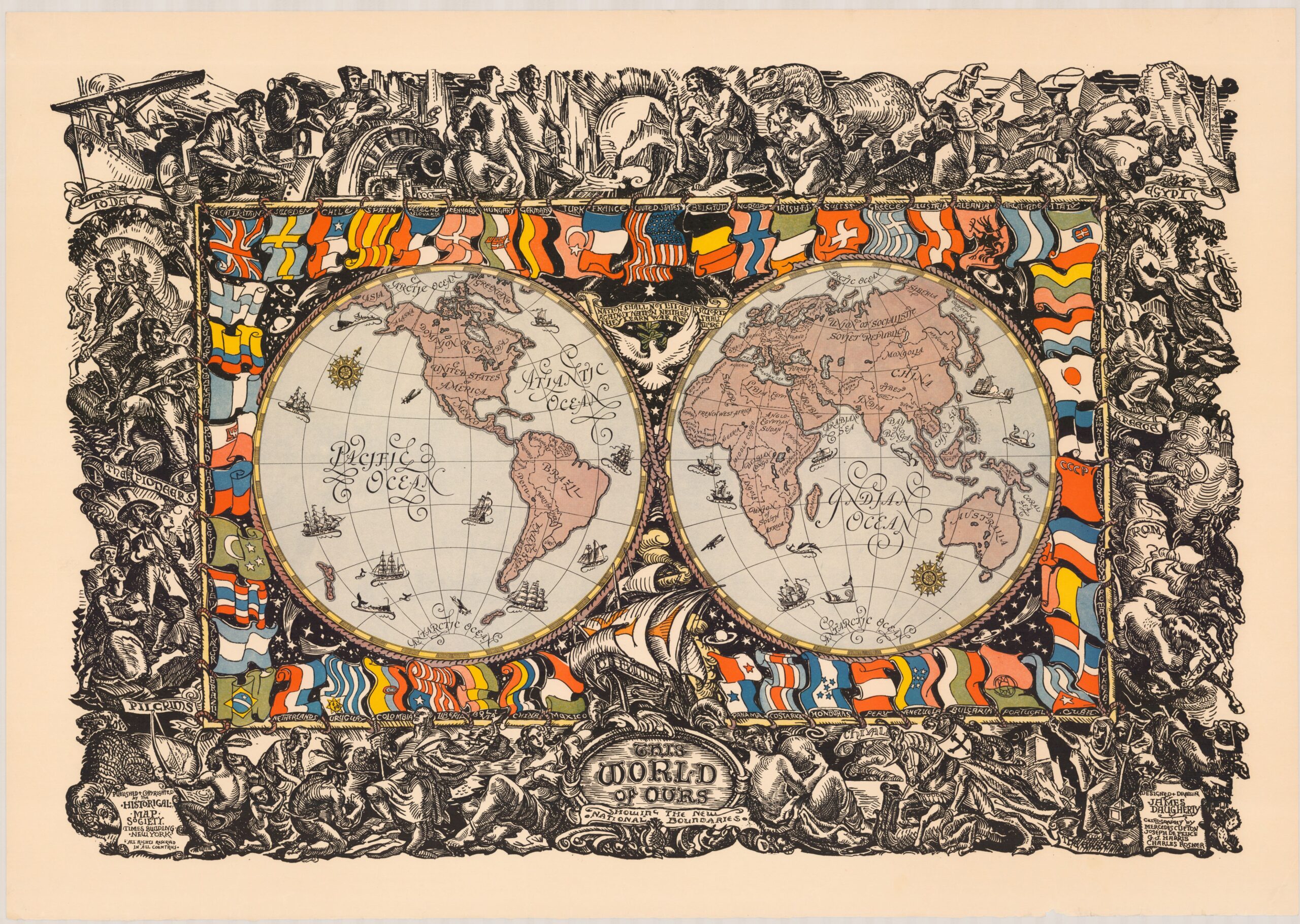
This map, painted by James Daugherty, depicts the world during the interwar period.
The map was published in the United States in February 1929, more than ten years after the end of the First World War and when the country was at the peak of its economic boom. With this map, the author sought to enhance the position of the United States as the central axis for maintaining peace and progress throughout the world.
Around the world map, you can see the flags of 52 nations, with the United States flag in the upper centre. An interesting detail about the flags listed is that of Spain, which does not correspond to the one used at that time, but is a kind of hybrid between the señera and the flag of Spain.
The outer frame emphasises the progress of humanity. At the top, above the flag of the United States, references to prehistory can be seen, followed clockwise by the following events:
- Slavery in Egypt.
- The thinkers of Ancient Greece.
- The conquests of Rome.
- The Crusades.
- The discovery of America (in the lower central part).
- Missionaries and conquerors in America.
- The pioneers who arrived in the western United States.
- Technological advances in the late 19th and early 20th centuries.
The map is a great example of subtle and elegant propaganda. The story told by the outer frame speaks of progress and bases it on the great civilisations of the past, then places all the advances made in the United States since its independence on the same level. Nor is the position of the American flag or the fact that the discovery of America is placed at the bottom coincidental.
Sources

