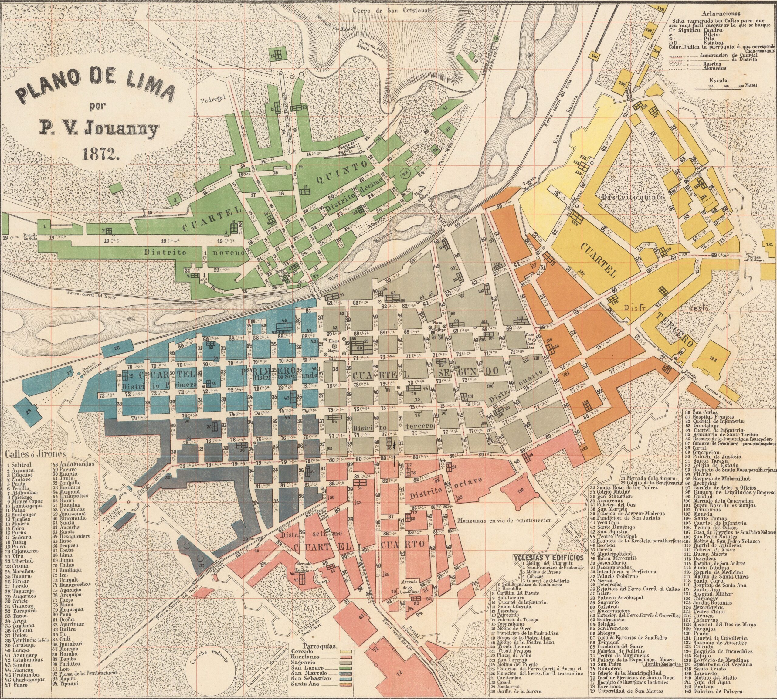
This map, drawn by P.V. Jouanny, depicts the city of Lima in 1872. It was published in Hamburg, Germany, as part of a larger print that includes the old street names and their correspondence with the new names. The illustration still shows the city walls, even though their demolition had been approved in 1768 and carried out throughout 1871, a year before this document was published.
The map is accompanied by colours, which represent the different parishes into which Lima was divided at that time:
- Fence, in yellow
- Orphans, in pink
- Sagrario, in grey
- Saint Lazarus, in green
- Saint Marcellus, in dark blue
- San Sebastián, in light blue
- Saint Anne, in orange
The map also has an extensive legend describing the correspondence between the numbers of the streets and their names, as well as a list of the 143 most representative buildings and churches in the city.
Sources

