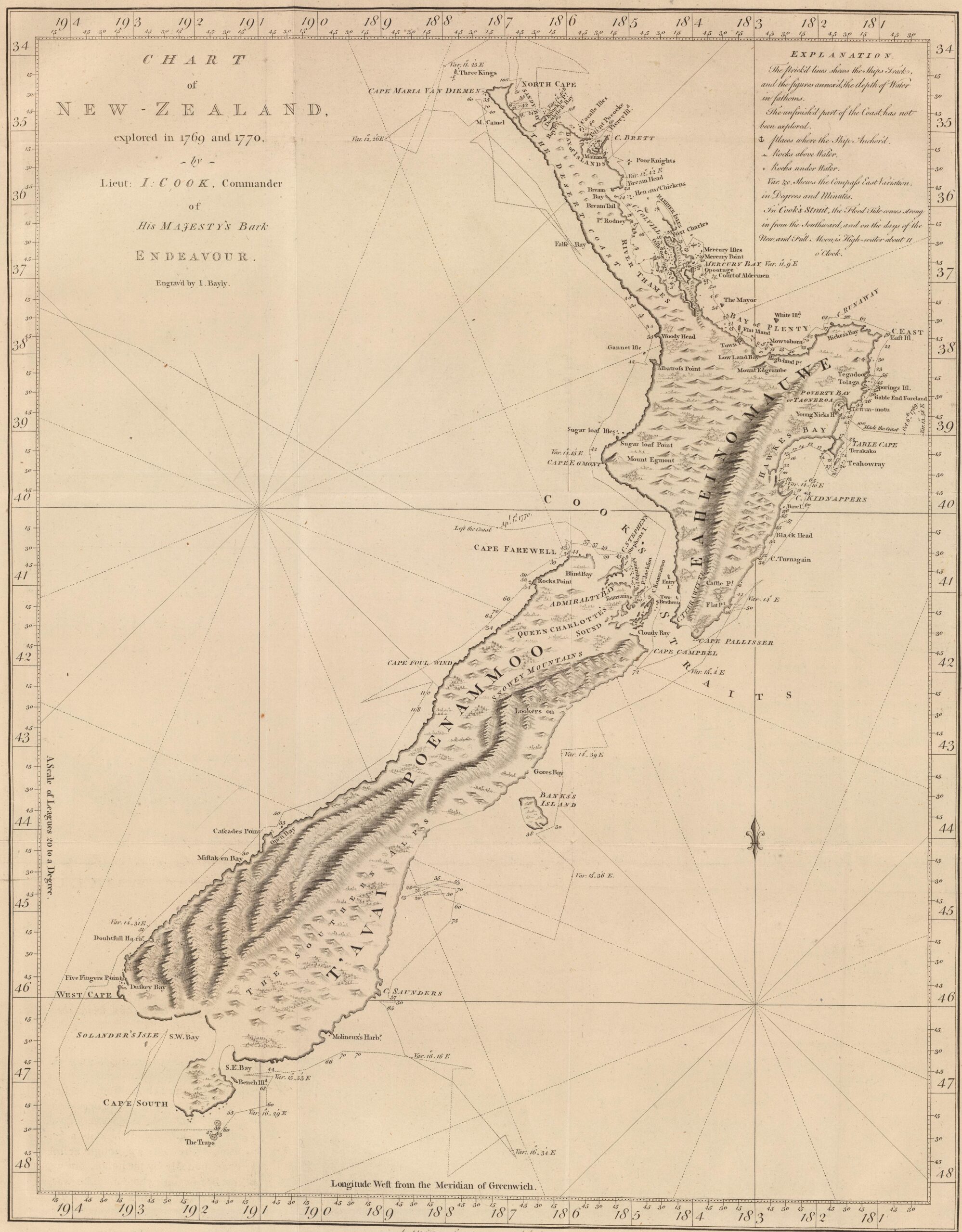
This map, drawn by John Hawkesworth in 1773, represents John Cook's readings on his first voyage of exploration of the Pacific Ocean, during which he travelled along and mapped the coast of New Zealand for the first time between 1770 and 1771.
The map includes a wealth of details about this journey, marking multiple milestones and geological features observed along the way:
- The dotted line shows the route taken by the HMB Endeavour.
- The numbers represent the depth of the water in fathoms.
- An anchor appears to indicate the locations where the HMB Endeavour docked.
- Small points indicate the islets above sea level.
- A «+» sign indicates rocks below the sea surface that may pose a problem for navigation.
- «Var.» indicates the course readings taken at some of the points.
Cook did a fascinatingly accurate job for the time and the means available, although he made a couple of mistakes that are clearly shown on the map. On the South Island, in the eastern part, Banks Island is drawn, which is actually a peninsula. Conversely, in the south, Cape South is marked as a peninsula, although it is actually Stewart Island, the third largest island in the archipelago.
Sources

