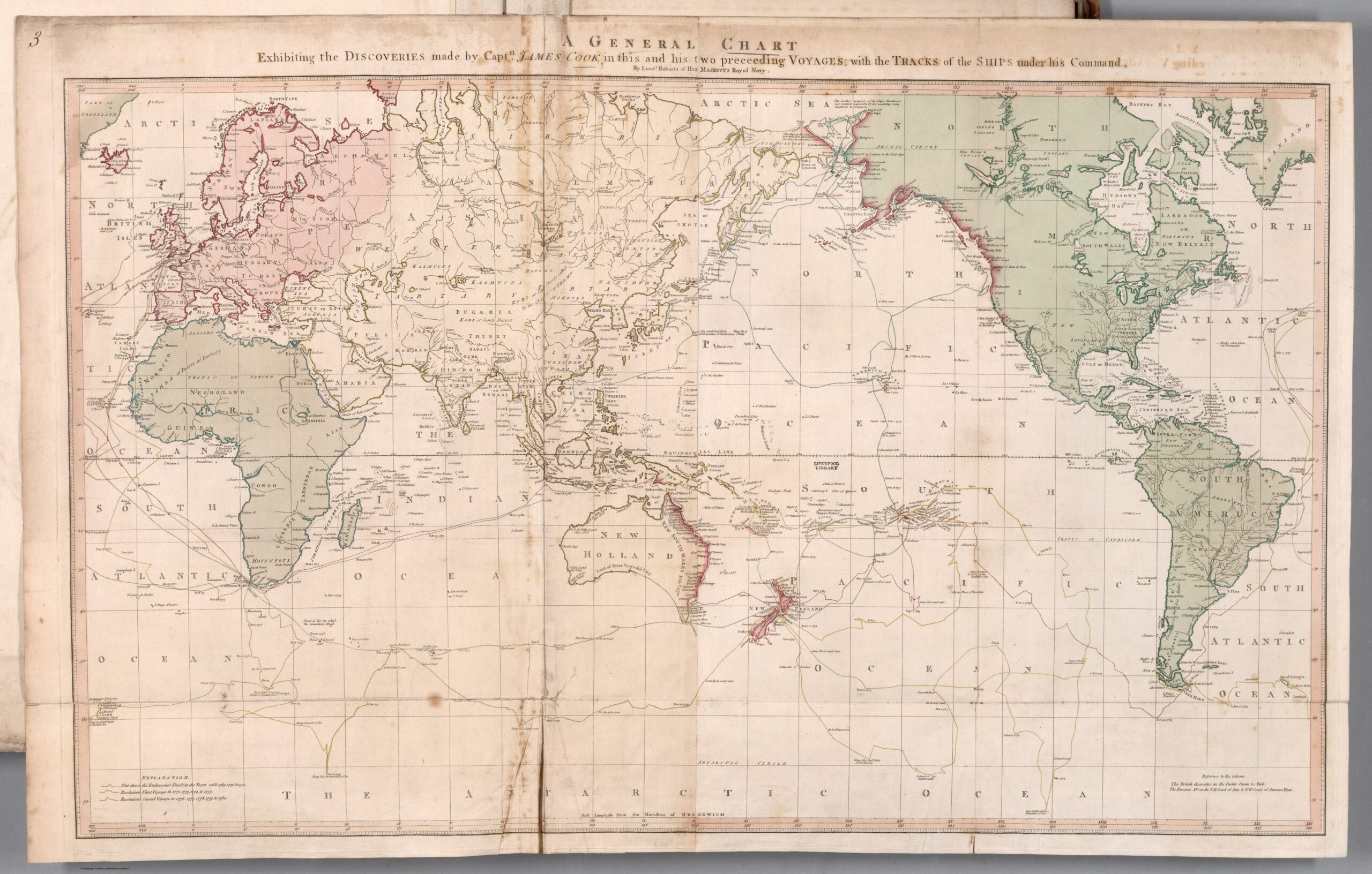
This map, published by William Faden in 1794, depicts the world and includes the discoveries made by explorer and cartographer James Cook on his voyages. All of these voyages lasted a similar length of time, three years, and departed from England, as they were all funded by the Royal Society.
The three journeys can be seen described on the map with dates at each stop:
- First Voyage (1768–1771): marked in red.
- Second Voyage (1772–1775): marked in yellow.
- Third Journey (1776–1779): with a green route.
During these voyages, Cook discovered several Pacific islands for Europeans, including the Hawaiian archipelago, which he initially named the Sandwich Islands. On his three voyages, he also devoted himself to mapping in great detail some regions of the Pacific Ocean, such as the north-east coast of Australia, New Zealand and the Pacific coast of Alaska.
Sources

