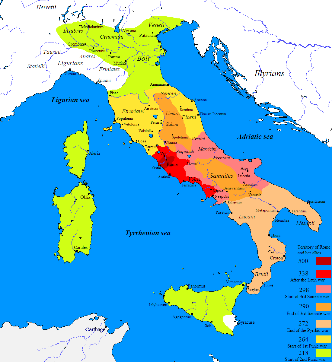
This map, created by Javierfv1212 for Wikimedia Commons in 2009, shows the expansion of the Roman Republic across Italy between 500 BC and 218 BC.
The map uses some of the most important events in the Roman Republic to show its progressive expansion:
- In maroon, the expansion of the Roman Republic in 500 BC. In this other map You can see what the situation was like in this region during this period.
- In red, the expansion of the Roman Republic after the Latin Wars (338 BC)
- In pink, the extent of the Roman Republic at the beginning of the Third Samnite War (298 BC)
- In orange, the expansion of the Roman Republic at the end of the Third Samnite War (290 BC)
- In light orange, the expansion of the Roman Republic at the end of the Pyrrhic Wars (272 BC)
- In yellow, the extent of the Roman Republic at the beginning of the First Punic War (264 BC)
- In green, the extent of the Roman Republic at the beginning of the Second Punic War (218 BC)
Sources

