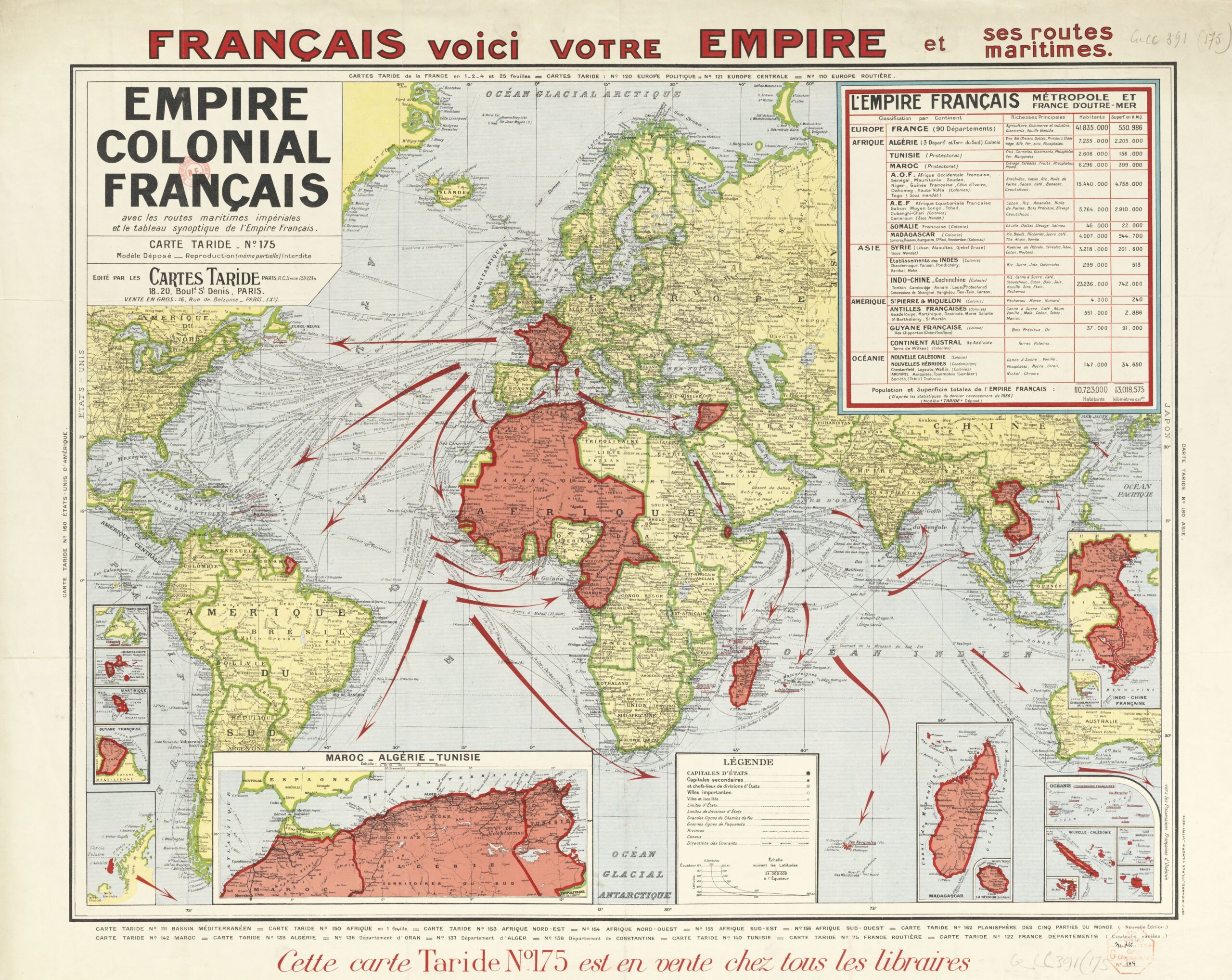
This map was published by Taride, a Parisian publishing house, in 1938. The map shows all of France's possessions around the world, as well as the various maritime transport routes.
The map, which is clearly propaganda, is very reminiscent of the well-known map of the British Empire in 1886. With the same intention, this publication seeks to raise awareness among French society of the greatness of the French Empire and how its dominion reaches every corner of the world.
Taride's illustration includes numerous details of some of the smaller and larger possessions, such as detailed maps of the Maghreb, French Guiana, Madagascar, Indochina and the islands of the Pacific Ocean.
Sources

