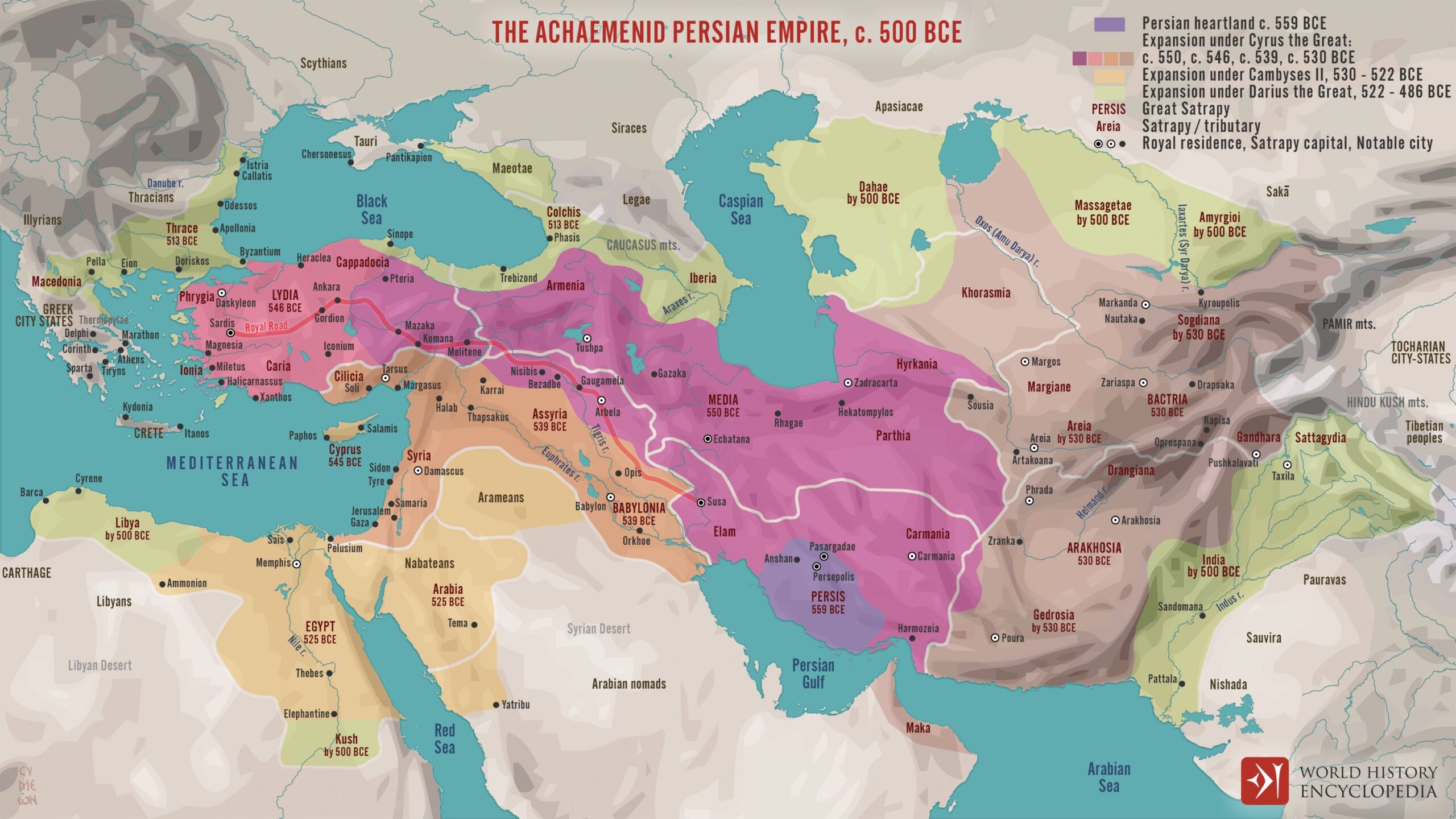
This map, published by Simeon Netchev According to World History Encyclopedia, it represents the expansion of the Achaemenid Empire between 559 BC and 486 BC, when it reached its maximum extent.
In the illustration, the author uses different colours to represent the phases of expansion of the empire over time:
- Purple: Original territory of the Achaemenid Empire, around Persepolis, north of the Persian Gulf.
- Roses, dark orange, brown: Territory conquered under Cyrus II the Great, when Mesopotamia and Anatolia were conquered and they reached India.
- Light orange: Territory conquered by Cambyses II, when part of Arabia and Egypt were conquered.
- Green: Territory conquered by Darius I, when the Empire entered Europe by taking Thrace, and extended its control towards Libya, the Caucasus, Central Asia and India.
The map also shows the territorial organisation into seven major satrapies and their subdivision into satrapies. This division is the most widely accepted during the reign of Darius I, but there are differences in various sources.
Sources

