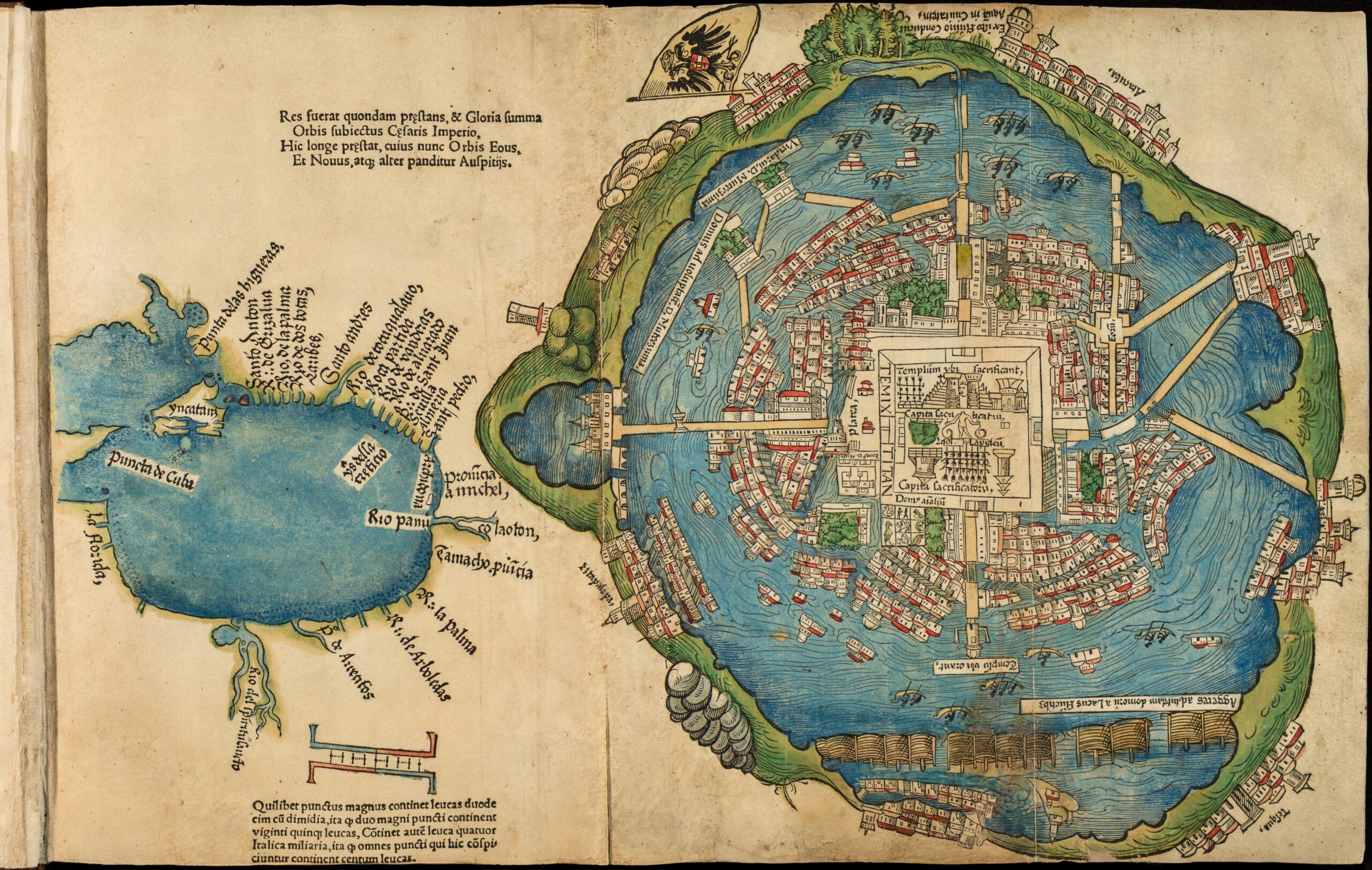
This map of Tenochtitlan is a German reproduction from 1524 of the map made by Hernán Cortés and sent to Charles I (and V of Germany) in the second of five letters sent to the monarch.
The Aztec city of Tenochtitlan was founded in 1325 on an island located in what was then Lake Texcoco. The city was besieged in 1521 by Hernán Cortés' army and destroyed in May of that same year. After its destruction, the city was occupied by the Spanish conquistadors, who replaced the Aztec buildings with new constructions.
One of the most notable features of this map is that it shows Lake Texcoco, the largest of the lakes that made up the lake system in the north-west of the Valley of Mexico. It also highlights the importance of chinampas, a Mesoamerican method of land expansion consisting of land on rafts, which increased the productive area and, in the case of Tenochtitlan, the size of the city.
Sources

