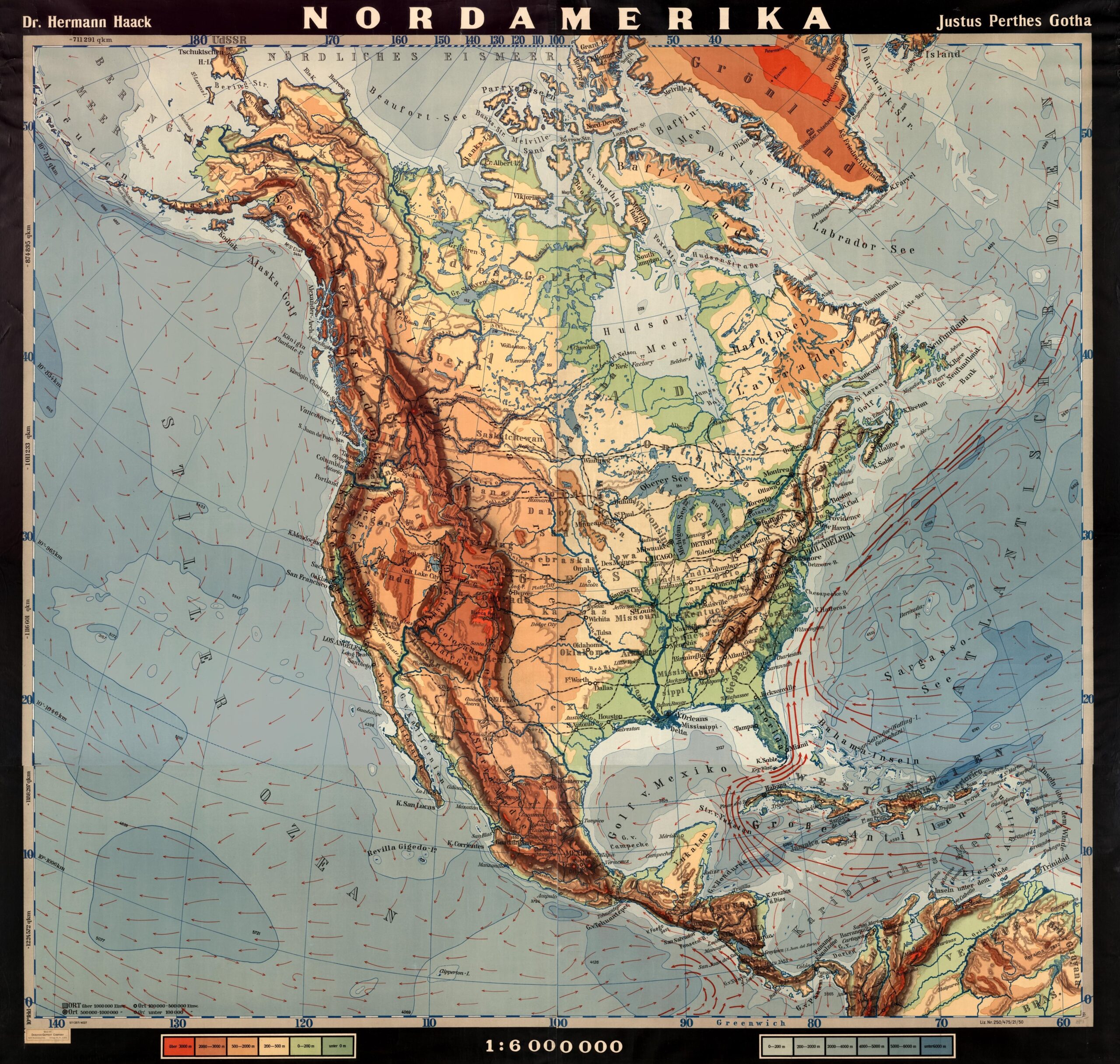
This work, created by German cartographer Hermann Haack and published by Justes Perthes in 1950, depicts the physical map of North America and Central America.
The illustration uses the classic colour range of a physical map:
- Green for the low plains.
- Orange and yellow for medium altitudes.
- Brown and red for the highest mountains.
- Deep blue to describe river courses.
- Light blue for shallow maritime areas.
- Dark blue for deeper maritime areas.
In addition, the map also includes red arrows in the Pacific Ocean, the Caribbean Sea, the Gulf of Mexico, and the Atlantic Ocean to show the prevailing water currents.
Sources

