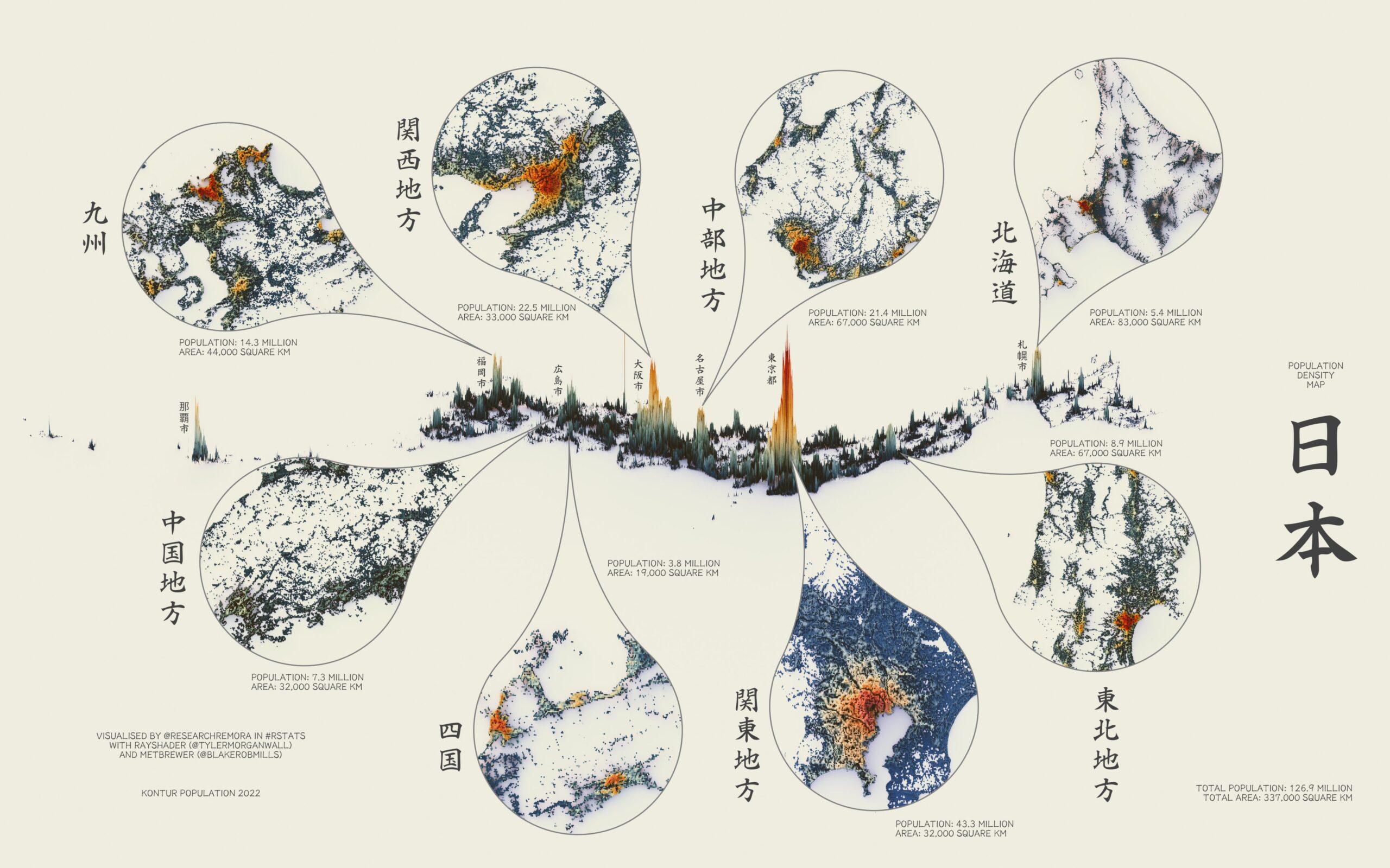
This illustration, created by Terence Teo, represents Japan's population density on a three-dimensional map. To do this, Terence extracted the data available at Kontur Population with which it generates columns using a programme, with a height that represents the population density at each point.
The map contains details of Japan's eight main regions, providing aerial views to give a clearer picture of the extent of urban agglomerations.
This map of Japan quickly shows that the highest population density and largest area are found in Greater Tokyo. To the left of the large peak of Tokyo are the other two large urban agglomerations on the island of Honshu: Nagoya and Osaka. At both ends, you can see the country's other two large urban agglomerations: Fukuoka, on the island of Kyūshū, and Sapporo, on the island of Hokkaidō.
Sources

