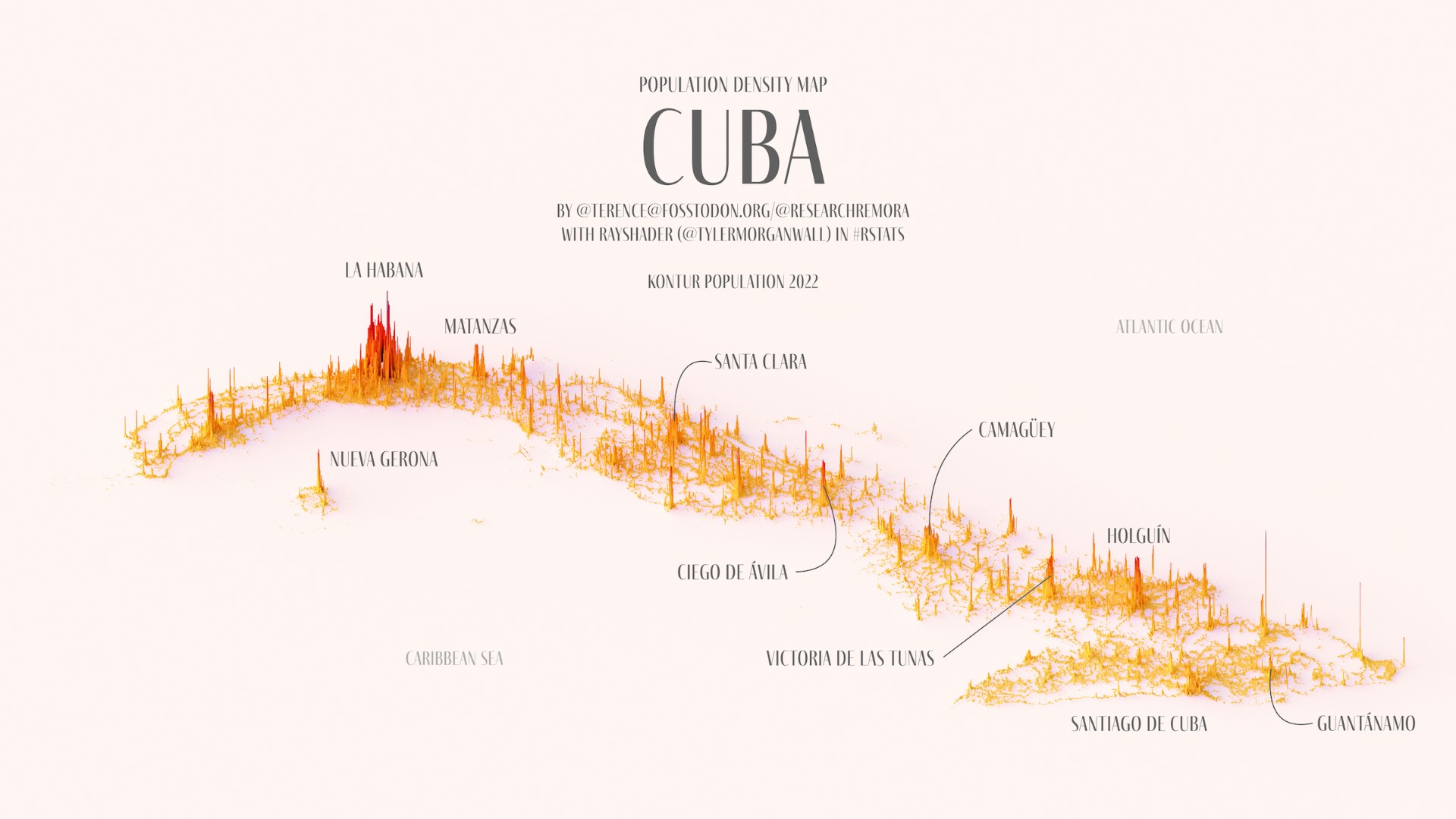
This illustration, created by Terence Teo, represents Cuba's population density on a three-dimensional map. To do this, Terence extracted the data available at Kontur Population with which it generates columns using a programme, with a height that represents the population density at each point.
This map of Cuba quickly shows that the highest population density is found in Havana and its surrounding areas. Significant peaks can also be seen in other large population centres such as Santiago de Cuba, Guantánamo, Holguín, Camagüey and Santa Clara.
Sources

