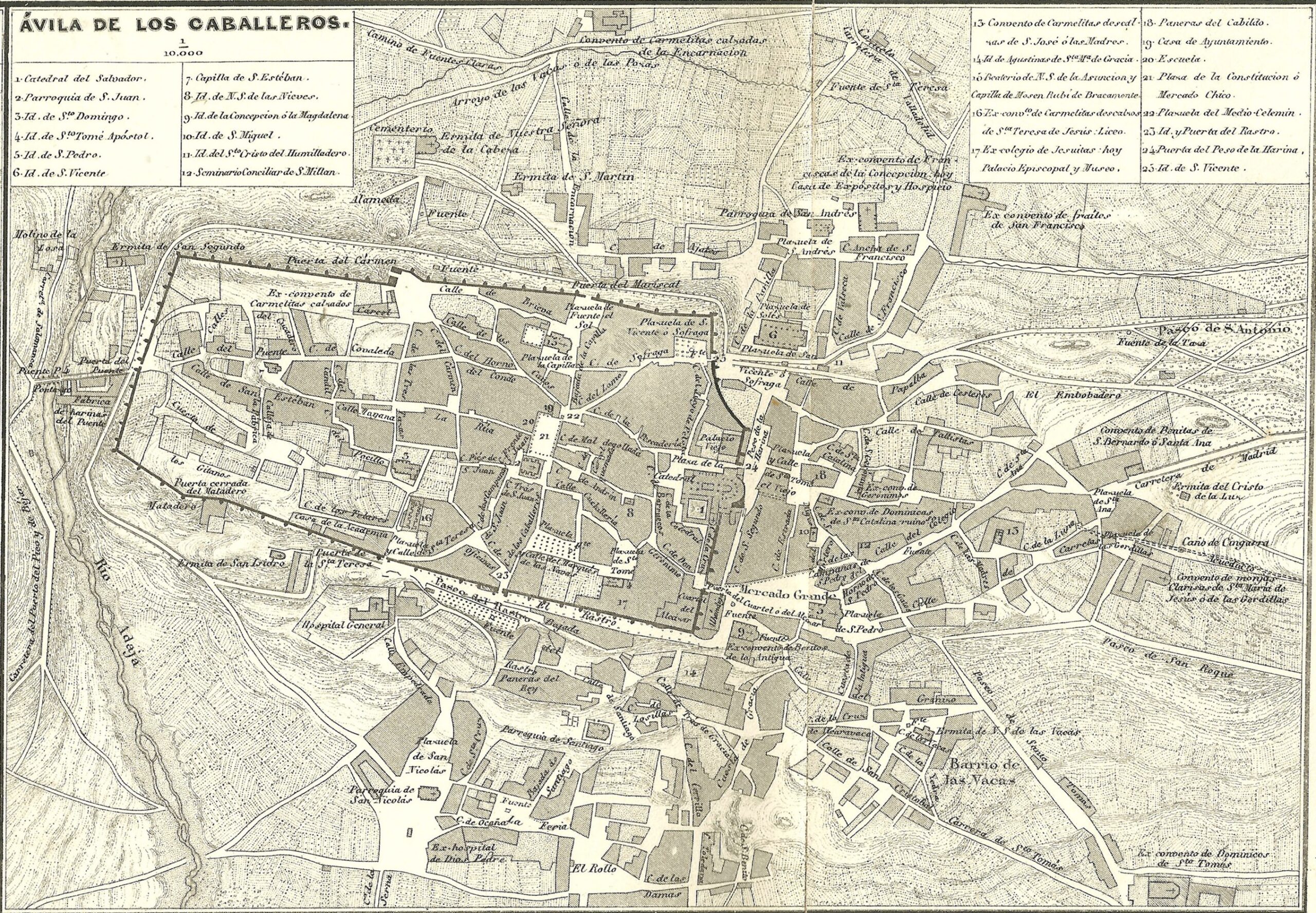
Map of the city of Ávila, known as Ávila de los Caballeros, published in 1864 by Francisco Coello. This plan forms part of a larger map of the province of Ávila, with the main towns in the province shown around the edges. It is one of the first accurate, to-scale representations of the city.
In the central part, you can see the city walls. The walls themselves are drawn in a darker colour, with their nine gates, two postern gates and 87 towers represented. Outside the walls, you can see how the River Adaja flows through the western part of the city, which was already expanding towards the east and south.
Sources

