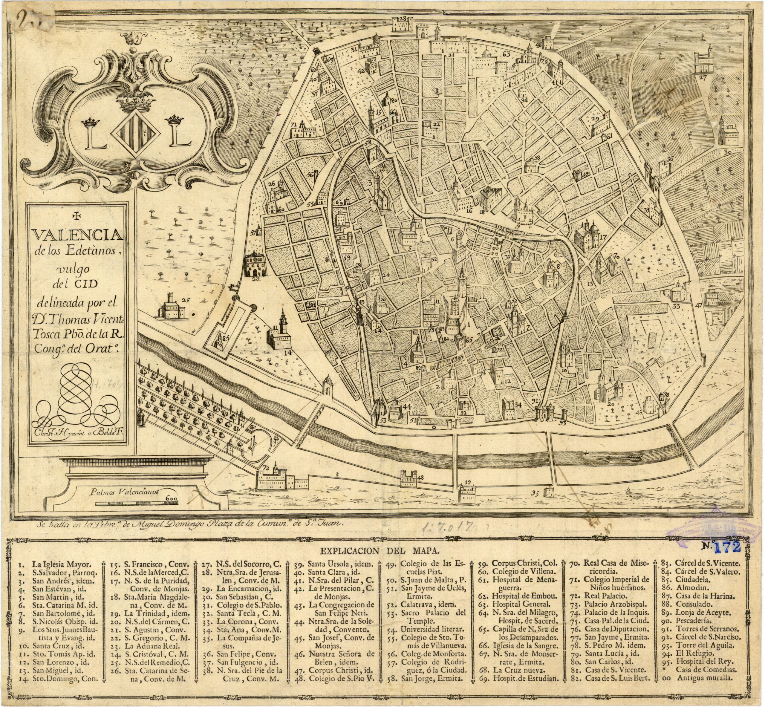
This map of the city of Valencia was drawn by Tomás Vicente Tosca in 1704 and is preserved in the Municipal Historical Museum of Valencia. This map was later modified by Antonio Bordazar and engraved for publication in 1738. The map is oriented with north at the bottom.
The map refers to the Edetani, the ancient Iberian people who inhabited much of what are now the provinces of Valencia and Castellón. The name of the people persisted in Roman times and is still used today to refer to the inhabitants of the municipality of Liria.
At the beginning of the 18th century, the city of Valencia still had its medieval walls, which would not be demolished until the 19th century. These walls enclosed a four-kilometre perimeter around the city with four main gates:
- Serranos Towers, to the north (at the bottom of the map)
- Puerta del Mar, to the east (on the left side of the map)
- Portal de San Vicente, to the south (at the top of the map)
- Torres de Quart, to the west (on the right-hand side of the map)
The old course of the Turia River can still be seen on the map to the north of the walled area. This would be redirected by means of the Southern Plan in the second half of the 20th century.
Sources
- Valencia of the Edetani, commonly known as El Cid – Virtual Defence Library
- Valencia of the Edetani, commonly known as El Cid 1738

