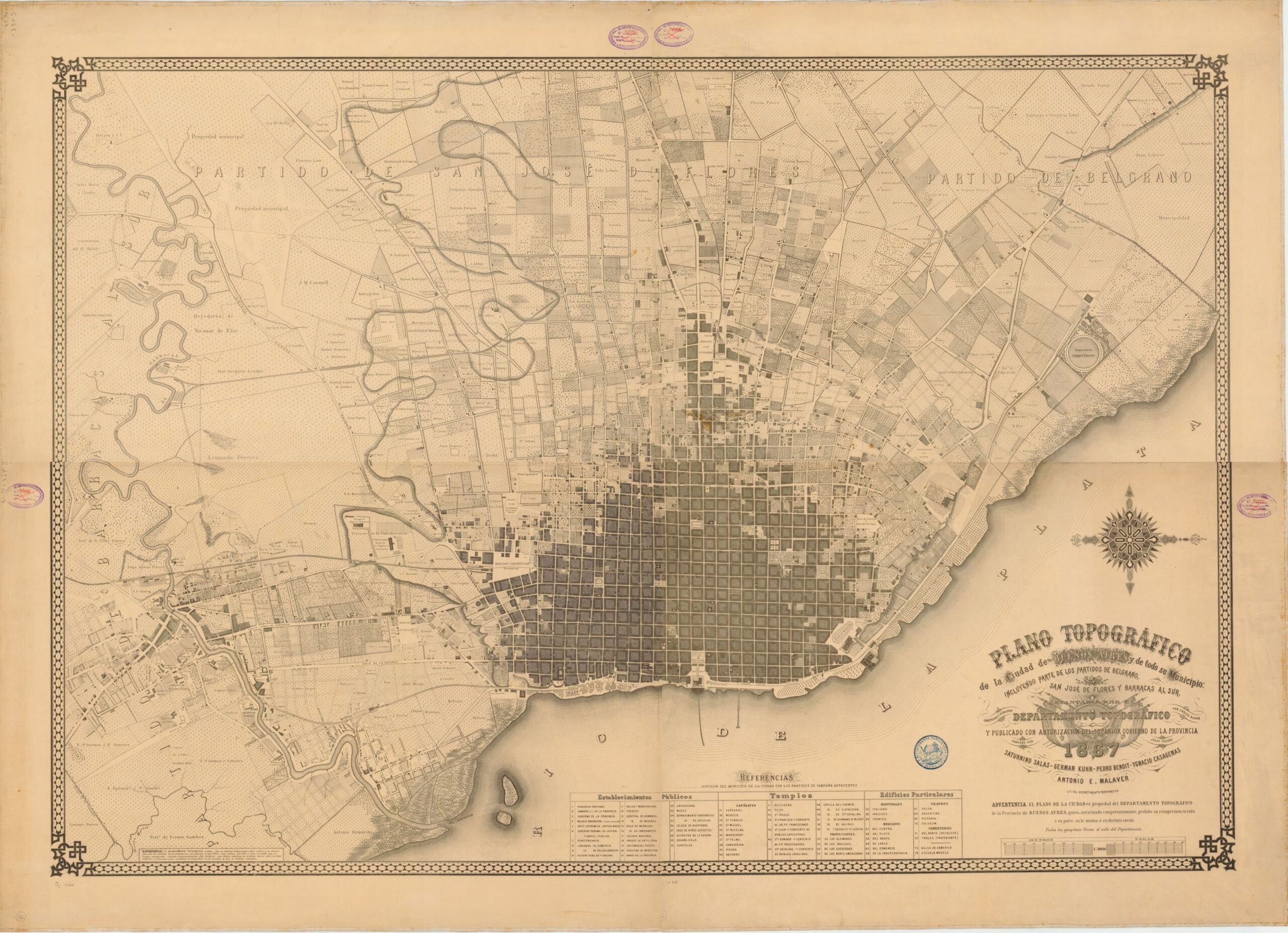
This map, drawn by Carlos Glade and engraved by Julio Vigier, represents the first topographical survey of the city of Buenos Aires. It was published in 1867 with the authorisation of the provincial government.
The population of Buenos Aires was around 150,000 in the mid-19th century. This map shows that in 1867, the city's population occupied the current neighbourhoods of San Nicolás, Montserrat, San Telmo, Constitución and San Cristóbal, as well as part of Balvanera. In the lower left corner, near the mouth of the Matanza-Riachuelo River, you can see the first buildings of what would become the popular neighbourhood of La Boca.
The compass rose in the lower right-hand corner shows that the map is oriented with north to the right.
Sources

