This map was created by Kalimedia (Story Maps) for Die Hanse, a European association with the aim of reconnecting the cities that were part of the Hanseatic League.
The Hanseatic League was one of the most important commercial (and defensive) federations during the 400 years it remained in existence, with almost total control of trade in northern Europe.
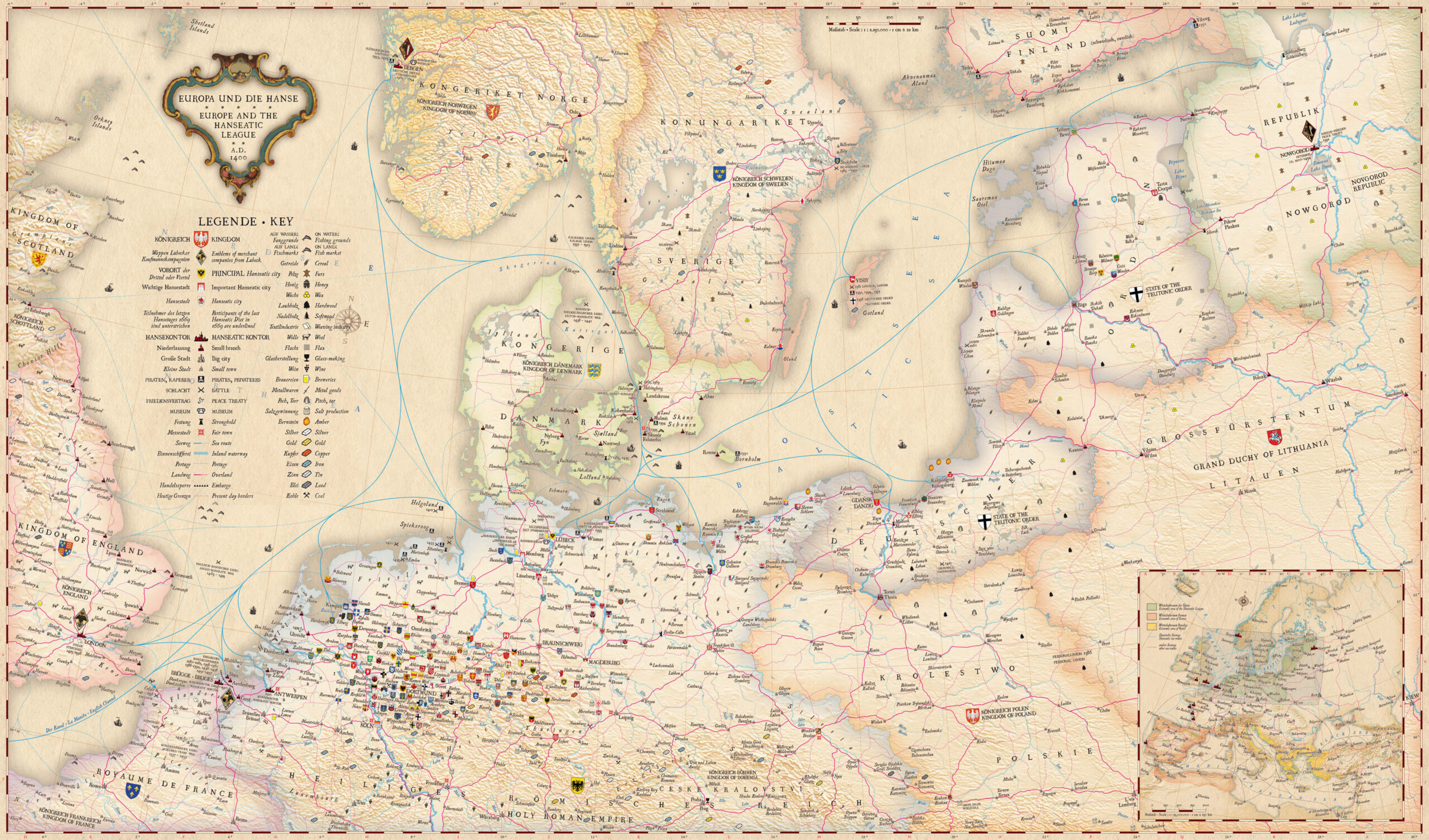
This detailed map shows multiple details about the League:
- The coats of arms of all the cities that were part of the Hanseatic League, using different sizes depending on their importance.
- Hanseatic League trading posts, marked with red icons, in cities such as London, Amsterdam, Antwerp, Bruges, Novgorod and Bergen.
- Maritime trade routes, in blue.
- Land trade routes, in pink.
- Icons representing the various commercial goods of each region, such as furs, fish, wood, wool, metals, coal, salt, beer, or wine.
Sources
- Map of the Hanseatic League
- Europe and the Hanseatic League 1400 AD by Kalimedia
- THE HANSA: A union with a long tradition – Member cities

