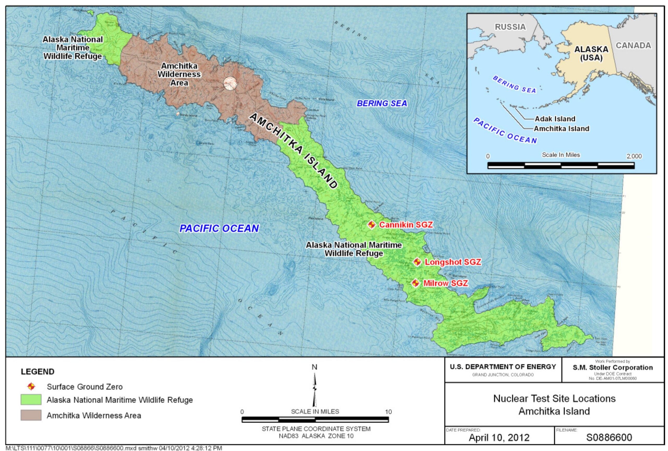
This map, published by the United States Department of Energy in 2012, shows the three nuclear tests that took place between 1965 and 1971 on Amchitka Island, Alaska.
This island, which was an important military base during the Second World War, was the site of a series of nuclear tests during the Cold War, despite being one of the most geologically active areas in the United States. The island has six active volcanoes within 150 kilometres and is also located near the epicentre of several earthquakes with a magnitude above 8.5.
Despite these conditions, the Pentagon decided to detonate five nuclear bombs on the island, among many other tests carried out around the world:
- Longshot, carried out on 29 October 1965, with an 80-kiloton underground bomb.
- Milrow, carried out on 2 October 1969, with a 1-megaton underground bomb.
- Cannikin, carried out on 2 November 1971, with a 5-megaton underground bomb.
Among other objectives, the tests on Amchitka Island sought to determine the extent to which earthquakes or volcanic eruptions could be induced. Although Cannikin did have an impact equivalent to a magnitude 7 earthquake, which can be watch this video, The area did not undergo any significant changes in its geological conditions during the following five decades.
Sources
- Amchitka Island, Alaska, Biological Monitoring Report 2011 Sampling Results (PDF)
- What happened when the US set off nuclear weapons in one of the most geologically active places on Earth?

