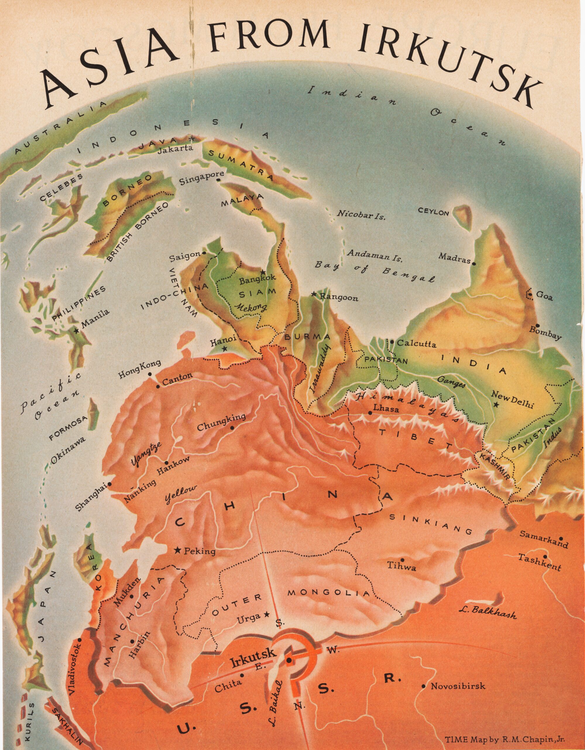
This propaganda map, created by Robert M. Chapin, was published in TIME magazine on 10 March 1952 alongside another entitled “Europe from Moscow”.
The map uses deep red to represent the Soviet Union and lighter shades of red for other satellite countries such as China and North Korea. In addition, the orientation of the map is changed to force the view of South Asia as two small appendages (Indochina and India) totally dependent on the Russian giant and its Chinese ally.
The text accompanying the map talks about the great physical barrier that the Himalayas represent for India, but that there is no equivalent barrier to prevent Indochina and Malaysia from being “infested” with communists, which will give the Soviet Union access to significant resources and wealth if no one stops it.
He delves into the idea that the Soviet Union is putting pressure on NATO members and praises Turkey and Greece for suppressing socialist and communist forces in their countries, serving as valuable allies against Soviet expansion.
Sources

