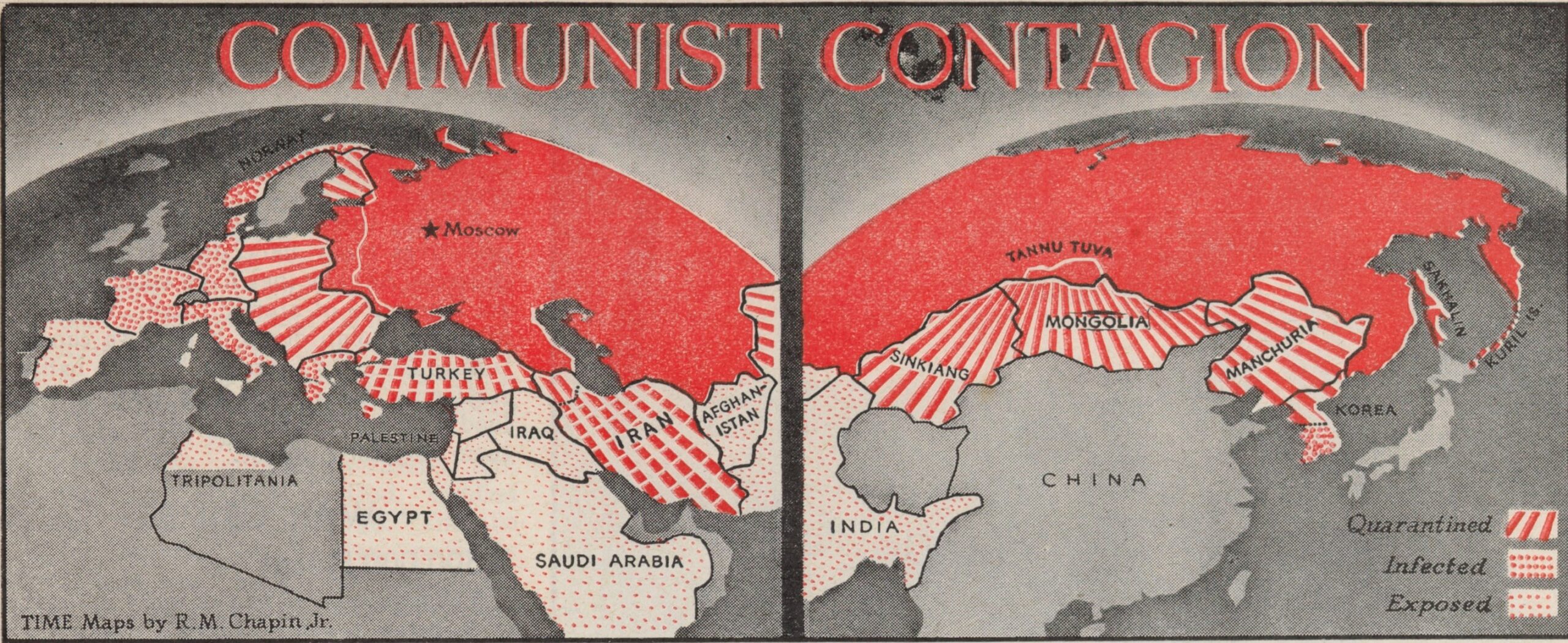
This propaganda map, created by Robert M. Chapin, was published in TIME magazine on 1 April 1946. It depicts communism as a virus spreading from the Soviet Union to the rest of the world.
In addition to the Soviet Union painted in red, there are three other representations in the legend:
- Red lines: This is how countries in “quarantine” are marked, including the entire Warsaw Pact, Iran, Turkey, Mongolia, Manchuria and North Korea.
- Large red dots: This is how the “infected” countries are shown, among which Chapin includes most European countries where socialist parties have some influence, such as Greece, Italy, Germany, and France.
- Small red dots: These represent the “exposed” countries, which Chapin includes Spain, Egypt, the entire Middle East, Afghanistan, and India.
This is one of the maps that marks the beginning of the Cold War after the end of the Second World War.
Sources

