Skip to content

Milhaud Maps

An extensive catalogue of maps - Subscribe to the Newsletter
  • Antique Maps
  • Propaganda Maps
  • Geographical Maps
  • Historical Maps
  • Data Maps
  • Political Maps
  • Urban Maps
  • Curious Maps
  • Map of Maps
  • Maps by country
  • Maps by year
  • A random map
  • Contact

Maps from 1952 (5 maps)

Physical map of Italy (1952)

Physical map of Italy (1952)

This map, created by Herbert Bayer, was published by the Agostini Geographical Institute in the Great Economic Geographical Atlas...

Milhaud 2025-10-09
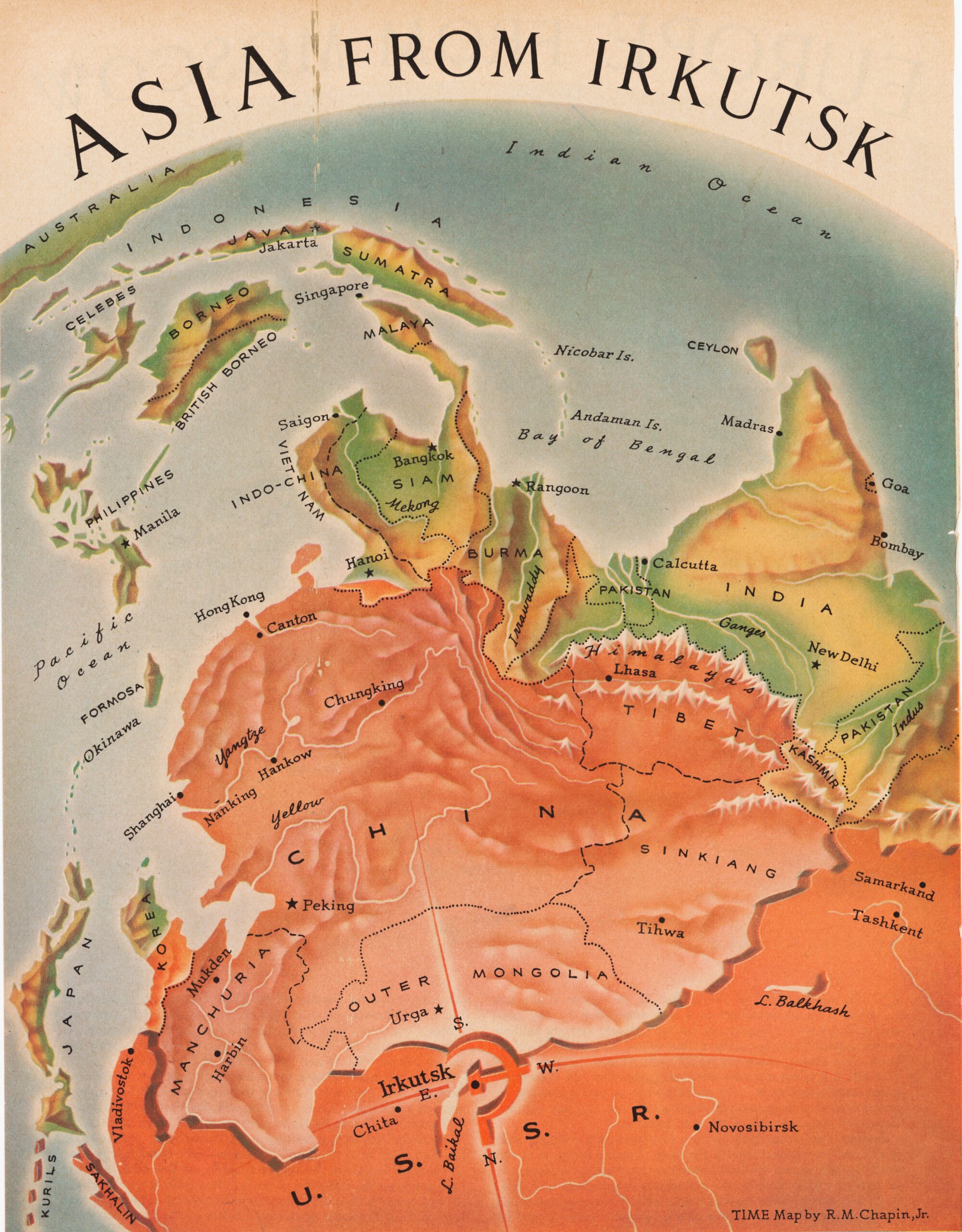
Asia from Irkutsk (1952)

Asia from Irkutsk (1952)

This propaganda map, created by Robert M. Chapin, was published in TIME magazine on 10 March 1952...

Milhaud 2023-01-02
The Indian Ocean line of Messageries Maritimes (1952)

The Indian Ocean line of Messageries Maritimes (1952)

This map was created by French illustrator Hervé Baille in 1952 to promote the new line inaugurated by the...

Milhaud 2024-03-28
Europe from Moscow (1952)

Europe from Moscow (1952)

This propaganda map, created by Robert M. Chapin, was published in TIME magazine on 10 March 1952...

Milhaud 2023-01-02
Kurdistan, the Nation Without Borders (1952)

Kurdistan, the Nation Without Borders (1952)

This propaganda map, drawn by Robert M. Chapin, was published by *Time* magazine in 1952, to accompany an…

Milhaud 2026-09-01
CC BY-NC-SA 4.0 | Milhaud Maps | Designed by: Theme Freesia | Cookie policy (EU)
We've detected you might be speaking a different language. Do you want to change to:
Change language to Español Español
English (UK)
Change Language
Close and do not switch language
EspañolEnglish (UK)