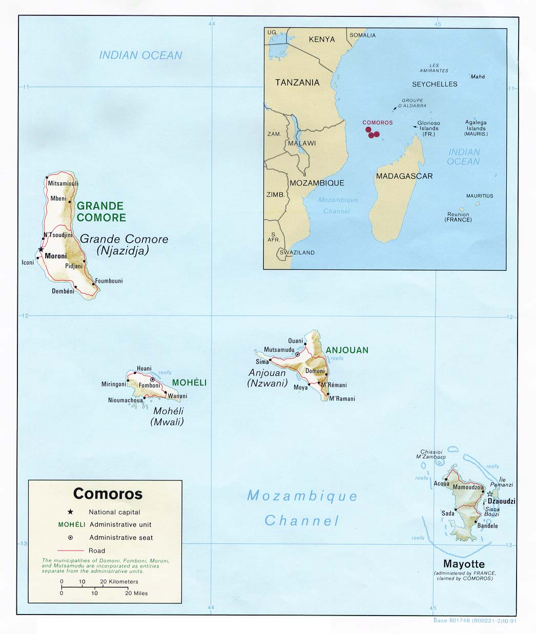
This map of Comoros was published by the CIA in 1991 and is currently held in the cartographic collection at the Perry-Castañeda Library (PCL) at the University of Texas at Austin, United States.
The map shows the three islands that make up the Union of the Comoros. It also includes the island of Mayotte, which is currently one of France's overseas departments, although the Union of the Comoros claims the island as its own.
Sources

