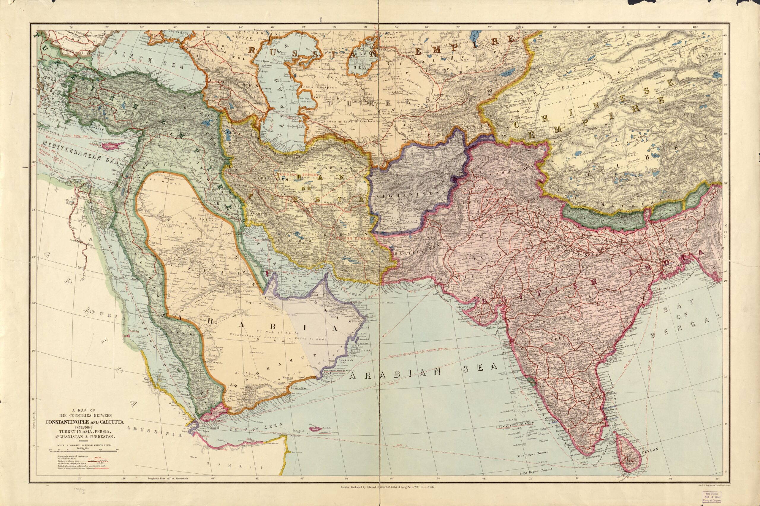
This map was published by Stanfords, a London publishing house, in 1912. It shows the political situation of all countries between Constantinople and Calcutta.
The map shows all the main players in the Middle East and South Asia;
- The Ottoman Empire appears in green, already labelled on the map as the Turkish Empire.
- Iran/Persia appears in yellow, with both names present on the map.
- Afghanistan is shown in purple.
- All the entities of the British Empire appear in pinkish red, including India, Cyprus and Aden.
- The Russian Empire's possessions in the region are shown in orange.
- The Qing Empire is shown in gold, labelled as the Chinese Empire.
The author also uses red lines to detail the different transport routes. By sea, dotted red lines show maritime routes. By land, existing railway lines are shown in solid red and proposed lines in dashed red.
As a curious detail, the map shows the area of influence that both the Russian Empire and the British Empire exerted over Persia at that time.
Sources

