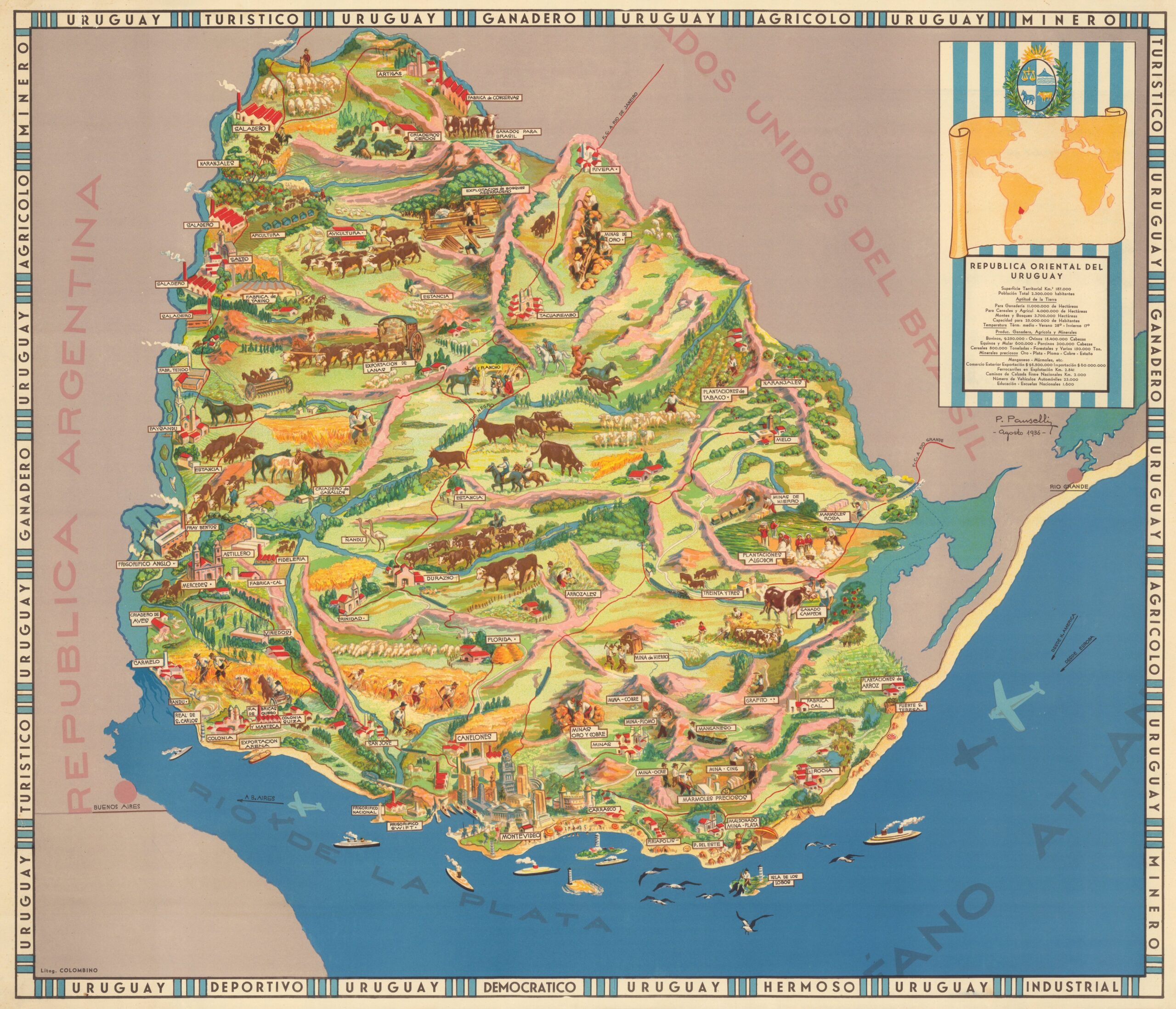
This map, drawn by P. Pauselli and printed by the lithograph Colombino of Montevideo in 1936, is a pictorial mural of Uruguay.
Despite having the aesthetics of a tourist map, the result has little to do with what a tourist map would look like today. With the exception of Montevideo, which appears with its most iconic monuments, the rest of the illustrations focus on the economy that sustained the country at the time of publication: cattle herds, plantations, mining operations and cargo ships.
In the perimeter border, this focus on the country's economy is deepened by interspersing the name of the country with other words such as tourist, livestock, agricultural, mining, sports, democratic or industrial. This propagandistic touch makes sense in the political context of Uruguay at the time. Gabriel Terra had been democratically elected in 1931, but in 1933 he dissolved parliament and ruled in an authoritarian manner until 1938. This map can be understood as an attempt by Terra to clean up his image, even with the ironic inclusion of the word 'democratic' in the outer frame.
If you would like to read more about pictorial maps, you can consult this article.
Sources

