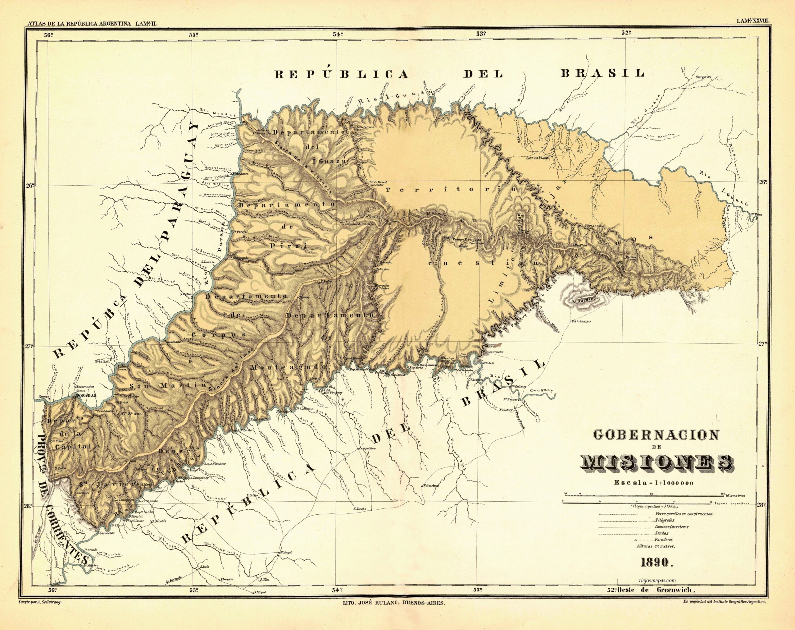
This map, drawn by Arturo Seelstrang, is part of the Geographical Atlas of the Argentine Republic, published by the Argentine Geographical Institute.
Entitled «Governorate of Misiones,» the map includes the territory that was then known as the National Territory of Misiones. This included the current province of Misiones and also a territory to the east that was disputed with Brazil, which appears labelled on the map as «territory in question». This territorial dispute continued until 1895, when it was submitted to international arbitration led by Grover Cleveland, President of the United States, who ruled in favour of Brazil.
It is also interesting to note how the Iguazú Falls appear on this map under their former name, Salto de Santa María.
Sources

