Relief map of India, by Miguel Valenzuela (2020)

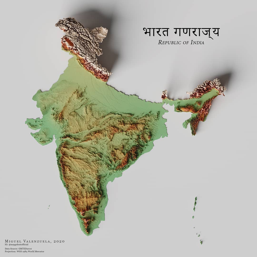
This map, created by Miguel Valenzuela, shows the relief of India. It uses three colours: green for low-lying areas, orange for mid-level areas and white for high-lying areas, simulating the country's flag. The author also uses shading, which highlights the steep areas.

Sources


If you like maps, don't hesitate to sign up for the newsletter (Spanish o English) and collaborate with the project. With the subscription, completely free of charge, you can have access to all the maps in the catalogue in high resolution.

Milhaud Maps Newsletter Newsletter A Cartographer's Tale