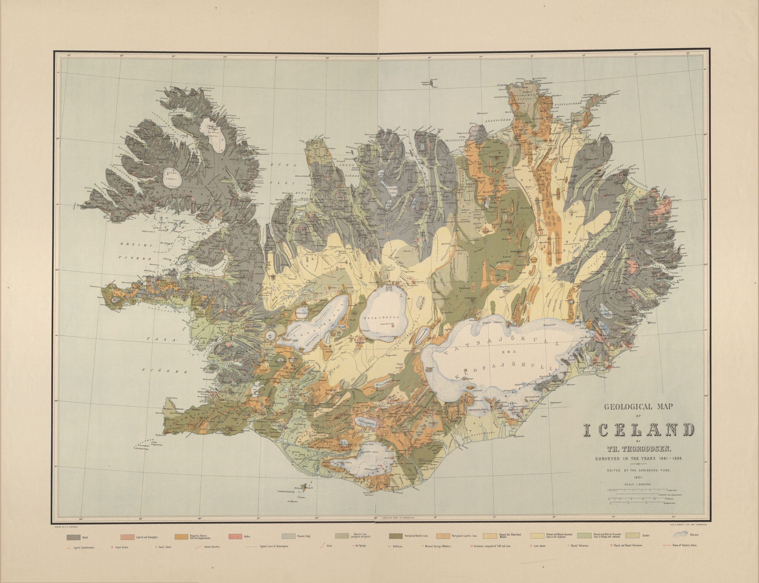
This map, published by Icelandic geologist and geographer Þorvaldur Thoroddsen in 1901, shows a detailed geological map of Iceland.
The different colours used on the map show the different types of soil, mainly of volcanic origin, given the geological situation of the island. Among these, the following stand out:
- Black: basalt.
- White: glaciers.
- Light yellow: sedimentary rocks of different types.
- Orange: palagonitic gaps.
- Dark green: post-glacial basaltic lava.
- Light green: pre-glacial doleritic lava.
In addition, the map also shows in red the location of various geological features linked to volcanic activity, such as faults, volcanic cones and hot springs. With a dotted red line, the map also shows the location of the coastline during the last glacial peak.
Sources

