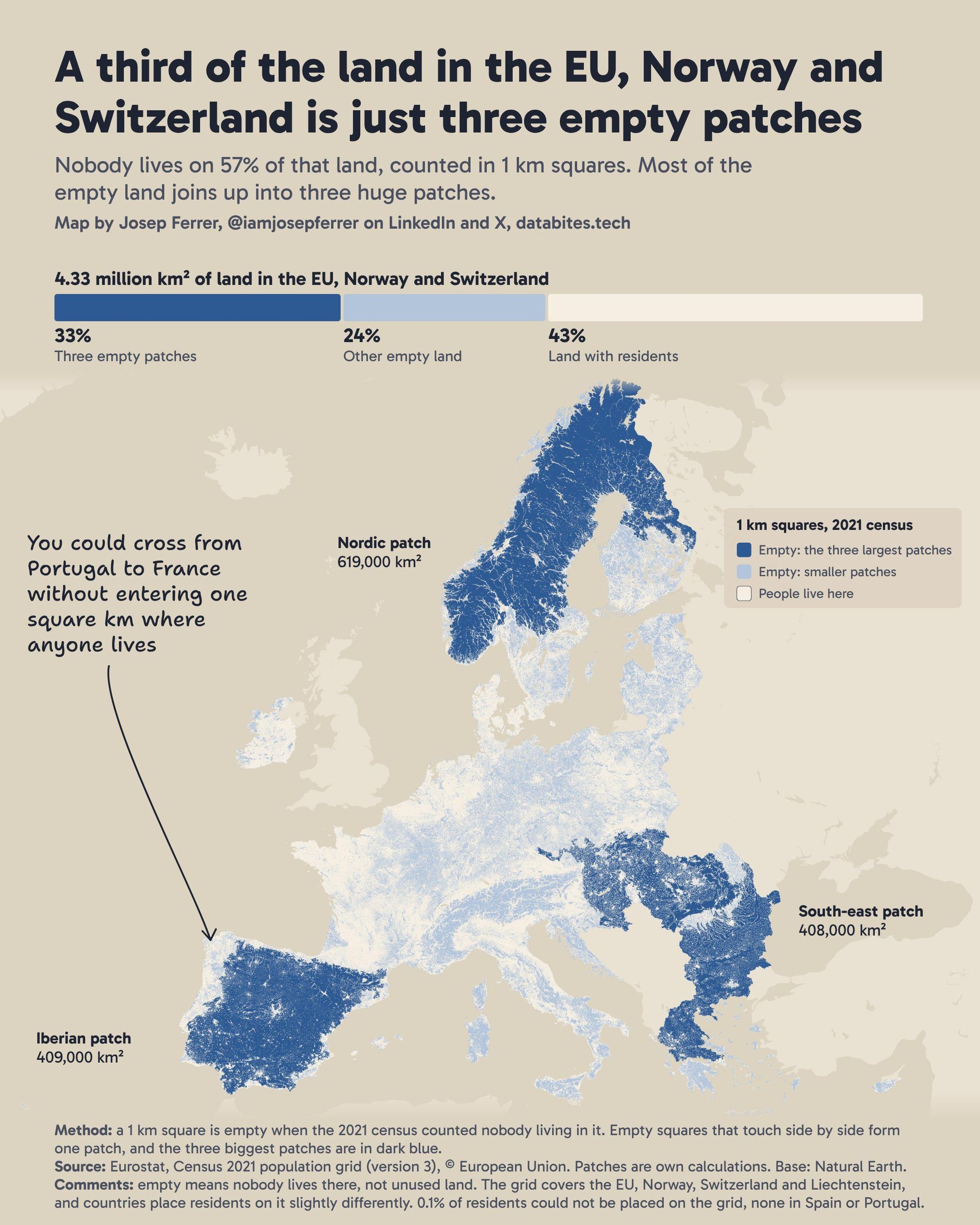
This map was published by Josep Ferrer in 2026 as part of the initiative 30-Day Map Challenge.
The author uses the Eurostat population grid as a basis, which divides the territory of the European Union, Norway and Switzerland into 1 km² cells, and marks on it those in which the 2021 census recorded no residents. These cells account for 57 per cent of the territory.
On the map, empty cells are grouped together when they share at least one side, which has helped the author to create three large clusters that are highlighted in dark blue:
- The Nordic region, covering 619,000 km².
- The Iberian Peninsula, covering 409,000 km².
- The south-eastern region, which stretches from Hungary and Croatia to Greece, covering an area of 408,000 km².
Together, these three blocks cover a third of the territory. Empty cells, which form smaller patches, are shown in light blue, whilst cells with at least one resident are shown in white. It is important to note that an empty cell does not mean that the area is uninhabited, but rather that no one is registered as living there.
You can find more information about the initiative here. #30DayMapChallenge in what I wrote in the newsletter.
Sources


 Español
 English (UK)