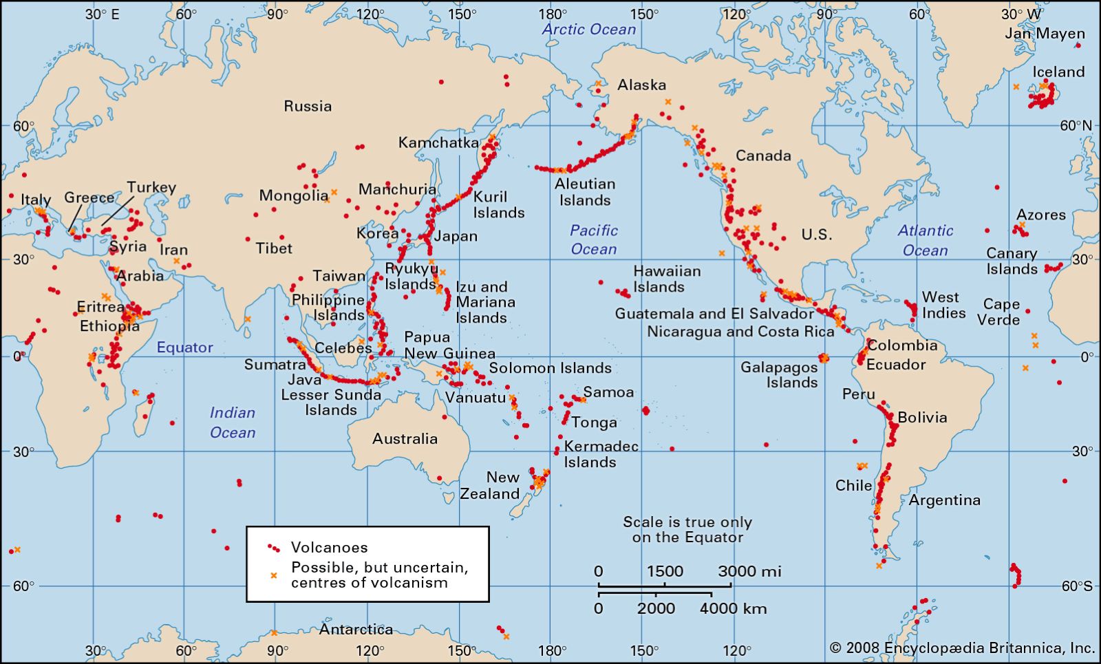
This map published by the Encyclopaedia Britannica shows all volcanoes that have been active worldwide over the last 10,000 years. The map distinguishes between volcanoes as such (red dots) and possible unconfirmed centres of volcanism (orange crosses).
This image is best understood when compared to a map of tectonic plates. The vast majority of volcanoes are distributed along the boundaries where two plates collide and convergent or destructive faults are formed. This is evident in the Pacific Ocean, where volcanoes are distributed along the entire Pacific coast of America. Other particularly active areas can also be observed:
- Southeast Asia and Indonesia, where volcanoes clearly mark the boundaries of the Sunda subplate.
- East of Taiwan and the Philippines, where volcanoes mark the Philippine Plate.
- Iceland, where there is more activity between the Eurasian Plate and the North American Plate.
- Japan, where the Philippine Plate, the Pacific Plate and the Eurasian Plate converge.
- New Zealand, where the Australian Plate and the Pacific Plate converge.
- Ethiopia and Kenya, where the Somali subplate is separating from the African plate.
- Southern Mediterranean, where the African plate and the Arabian plate meet the Eurasian plate.
In addition to all these points, there are many islands associated with hot spots, where magma emerges in the central part of a tectonic plate, as is the case with Hawaii and the Canary Islands.
Sources

