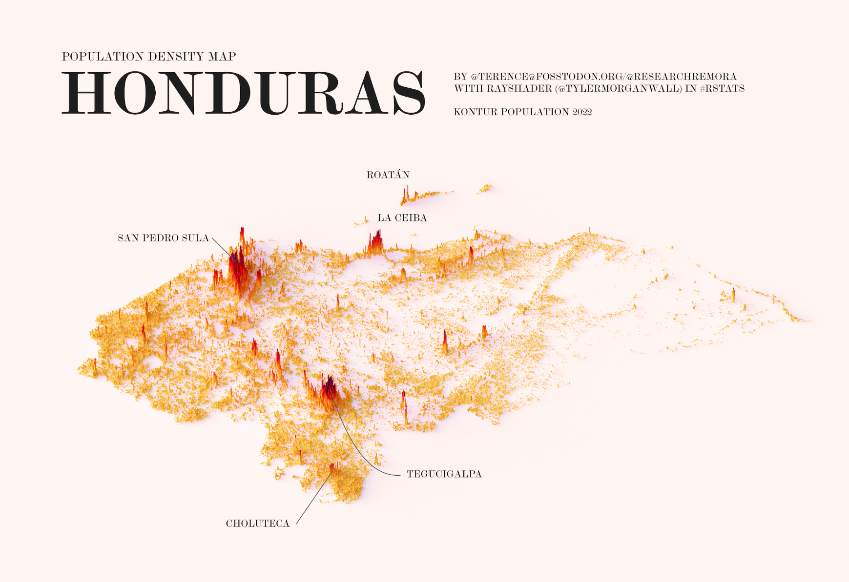
This illustration, created by Terence Teo, represents the population density of Honduras on a three-dimensional map. To do this, Terence extracted the data available at Kontur Population with which it generates columns using a programme, with a height that represents the population density at each point.
This map of Honduras shows two large population centres, one around Tegucigalpa, the capital, and the other around San Pedro Sula, the country's second most populous city. Other major cities are also labelled on the map, such as Choluteca, La Ceiba and Roatán, the most populous city in the Bay Islands.
Sources

