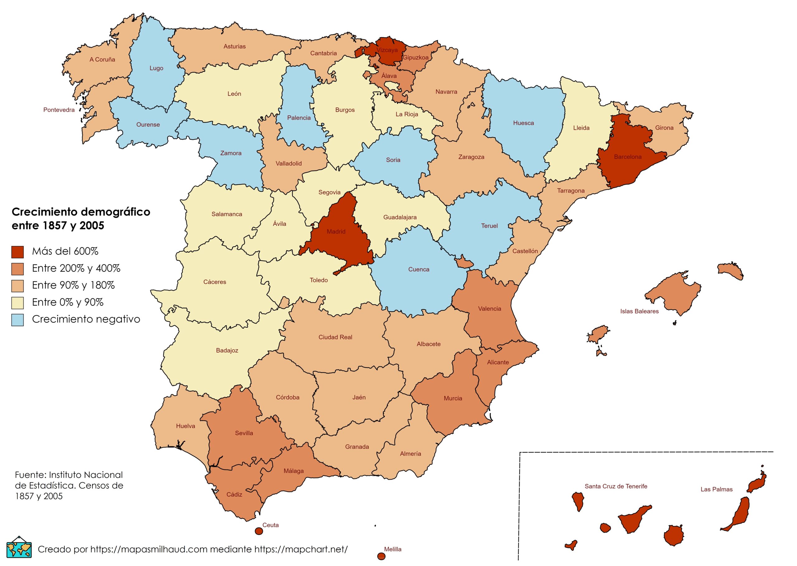
This map, created by Miguel García, shows the population variation in each province of Spain between 1857 and 2005, using census and register data published by the Spanish National Institute of Statistics.
The map shows that, although Spain's population tripled between 1857 and 2005 (from 15 to 45 million inhabitants), its distribution was very uneven. The coastal areas, Valladolid, Madrid and Zaragoza have seen their populations multiply several times over, while the vast majority of inland cities have grown slightly or even declined in population, as is the case in eight provinces.
Sources

