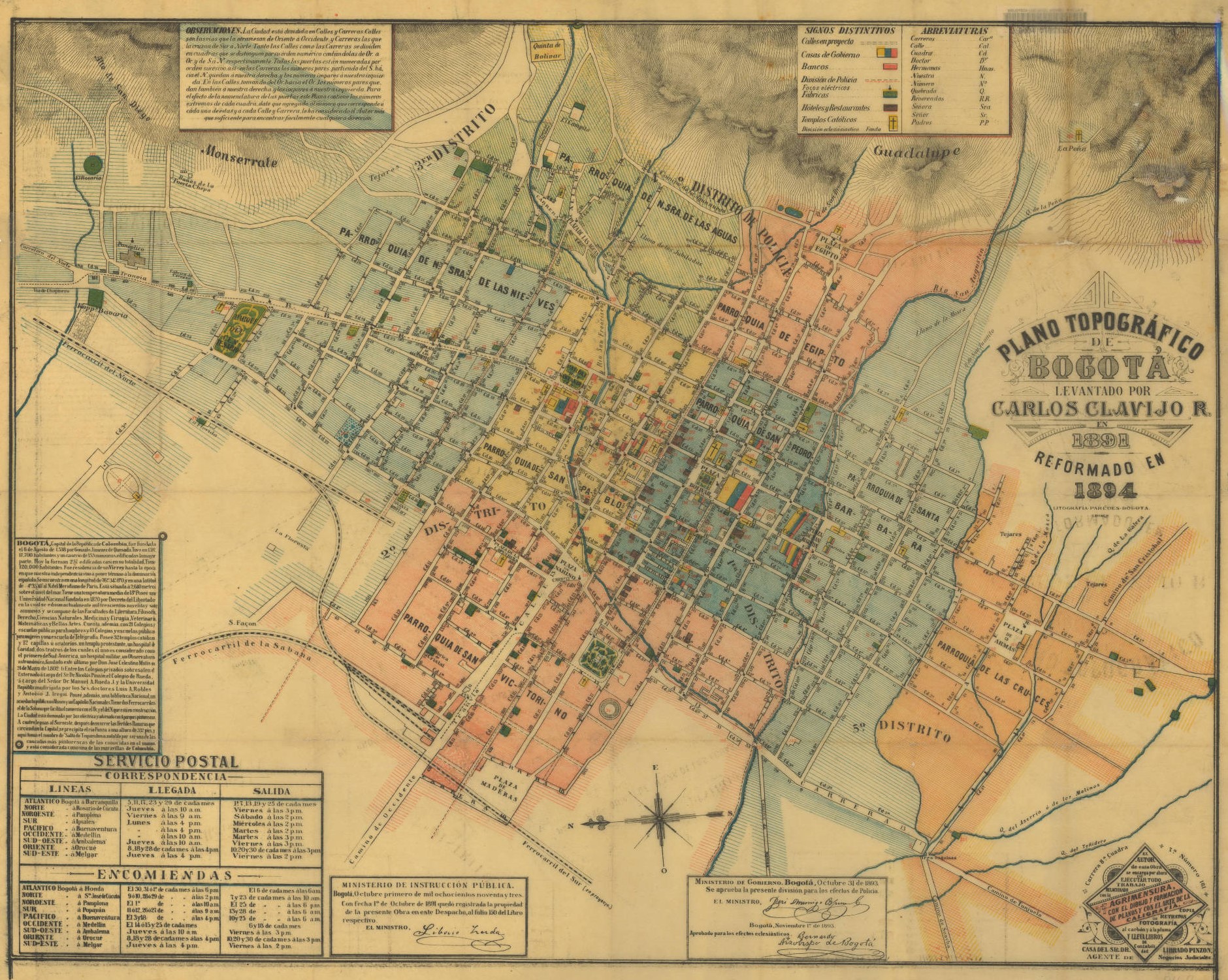
This map, measured and drawn by Carlos Clavijo in 1891 and subsequently modified in 1894, depicts the city of Bogotá. This copy is currently held in the library of the Bank of the Republic of Colombia. The work is oriented with east at the top of the map.
The entire built-up area is accompanied by colours that determine the different parishes that existed in the city at the end of the 19th century (from left to right and top to bottom):
- Parish Church of Our Lady of the Waters (in green)
- Parish of Egypt (in pink)
- Parish Church of Our Lady of the Snows (in light blue)
- Parish Church of Saint Paul (in yellow)
- Parish Church of St. Peter (in dark blue)
- Parish of Santa Bárbara (in light blue)
- Parish of Las Cruces (in orange)
- Parish Church of San Vitorino (in pink)
The map also includes a legend defining specific colours for each type of building:
- Government buildings (with the colours of the flag)
- Banks (in red)
- Factories (in green)
- Hotels and restaurants (in brown)
- Catholic churches (in yellow)
Sources

